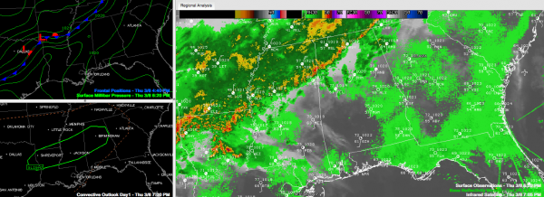
Limited Severe Threat Over Northern Third of Alabama
AS you can see in the lower left panel of the SimuAWIPS graphic, the SPC has put a slight risk severe weather outlook across an area roughtly within 75 miles either side of I-59 in Alabama tonight.
Instabilities are a little higher than anticipated and the storms over Mississippi have formed a pool of cold air aloft that will help them hold together as they push deeper into Alabama over the next couple of hours.
A severe thunderstorm warning continues for northern Lamar County around Sulligent, Beaverton and Vernon. Doppler radar does show very strong winds a short distance above the surface over southern Lamar County. These winds could reach the ground and be stronger than 60 mph.
The threat is not widespread, so a severe thunderstorm watch is not anticipated. There could be a few wind damage reports from the stronger storms though. The tornado threat is extremely small.
Category: Alabama's Weather, Severe Weather


