Red Letter Day in Weather History
What is the single most important development in the history of tornado forecasting and warning?Would it be Fawbush and Miller’s fortuitous forecast at Tinker AFB in Oklahoma in 1948?
Could it be the discovery of the hook echo on conventional radar in 1953?
Or would you vote for Weatheradio, which broadcasts warnings with a tone alert that activates specially equipped receivers?
Maybe it’s the internet and its flood of data.
Well…it could be argued that two of the biggest developments happened on the same date, 129 years apart.
On May 24, 1844, Samuel Morse transmitted the first message via telegraph wire between Baltimore and Washington D.C. His prophetic message from Number 23:23 read: “What hath God wrought?” The telegraph made it possible for alerts about storms to be sent ahead to threatened cities. The technology made forecasts and warnings possible.
While Morse’s historic message did change the face of weather forever, an event over a century later made advance warning of developing tornadoes a reality.
In the spring of 1973, a team of scientists from the National Severe Storms Laboratory in Norman, Oklahoma was preparing to attempt to intercept a tornado using their powerful experimental Doppler radar.
Conditions seemed to be right for the formation of tornadoes on May 24th, and a team of scientists were ready to try and capture a tornado on radar and in the field with an armada of instruments, video and still cameras.
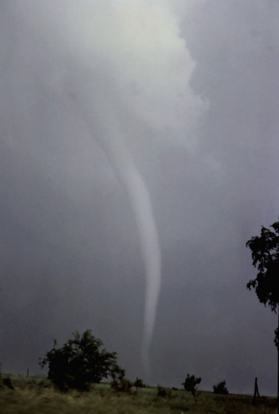
When an F4 tornado tore through the center of the farming community of Union City, Oklahoma that afternoon, everything came together.
It would take months, but researchers would discover two things: the mesocyclone and the TVS.
They would learn that the presence of a mesocyclone, or rotating thunderstorm often led to tornado formation.
The TVS, or Tornado Vortex Signature, was a strong radar indication that formed aloft about 25 minutes before tornado touchdown, and descended to the ground as the visible condensation funnel formed.
Today, we know that the presence of a mesocyclone is a precursor to tornado development in many cases. And a TVS on Doppler radar data is a very strong indication that a tornado is occurring or about to occur.
The Union City tornado would become the most intently studied storm up until that time. It forever erased any doubts about the potential value of Doppler radar as an operational warning tool.
Critics argue that Doppler radar has led to too many false alarms, but one tremendous benefit has been a higher success rate and real lead times for tornadoes.
Category: Met 101/Weather History


