Strong to Severe Storms This Afternoon
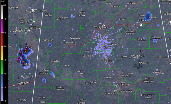
We continue to watch for storm development this afternoon across Alabama. A view of the composite reflectivity display from the Birmingham radar shows where the storms are forming this afternoon. Some places to look for in the next 30 minutes:
…east of Weaver and Jacksonville
…on the Fayette/Walker County line
…over Pickens and Sumter Counties
…northern Tuscaloosa County
A severe thunderstorm warning was just issued for Winston and Noxubee Counties in eastern Mississippi.
Storms that do form this afternoon could be severe, with damaging winds the main threat. Storms will be of the garden variety summer time type, which we call pulse storms. We call them this because they form quickly and rain themselves out quickly, choking on their own precipitation since there isn’t sufficient wind shear to make them lean with height, which separates the updraft and downdraft and lets the storms live long lives.
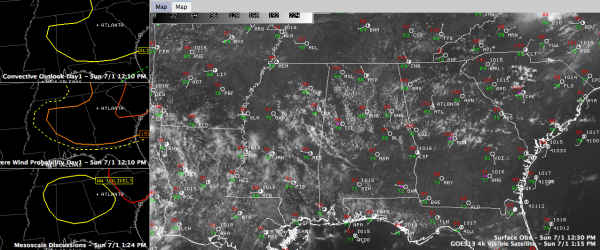
The SPC has issued a mesoscale discussion that includes part of the state. That is depicted in yellow on the bottom left panel of the graphic. They don’t expect to have to issue a watch. This is in addition to the slight risk that is in effect for the area. Here is the text of that statement:
SWOMCD
SPC MCD 011808
GAZ000-TNZ000-ALZ000-MSZ000-012045-
MESOSCALE DISCUSSION 1335
NWS STORM PREDICTION CENTER NORMAN OK
0108 PM CDT SUN JUL 01 2012
AREAS AFFECTED…PARTS OF THE DEEP SOUTH/TN VALLEY
CONCERNING…SEVERE POTENTIAL…WATCH UNLIKELY
VALID 011808Z – 012045Z
PROBABILITY OF WATCH ISSUANCE…20 PERCENT
SUMMARY…HIGH CAPE/LOW SHEAR SHOULD YIELD A PULSE-TYPE ENVIRONMENT
WITH SPORADIC LOCALIZED MICROBURSTS AND BRIEF/MARGINAL HAIL AS
ISOLATED TO SCATTERED TSTMS FORM ACROSS PARTS OF MS TO GA.
DISCUSSION…HOT TEMPERATURES IN THE UPPER 90S TO NEAR 105 AND PW
VALUES AROUND 1.5 INCHES ARE YIELDING VERY LARGE BUOYANCY WITHIN A
PLUME OF STEEP MID-LEVEL LAPSE RATES. ALTHOUGH DEEP-LAYER WIND
PROFILES ARE WEAK AND VARIABLE…INDICATIVE OF A
PULSE-TYPE/DISORGANIZED ENVIRONMENT…THE DEGREE OF INSTABILITY WILL
CERTAINLY SUPPORT A THREAT FOR MICROBURSTS AND PERHAPS BRIEF SEVERE
HAIL. PREDOMINATELY SLY MID-LEVEL FLOW MAY HELP STEER CONVECTION NWD
TOWARDS THE TN VALLEY…BUT OUTFLOWS WILL LIKELY EMANATE IN ALL
DIRECTIONS THIS AFTERNOON.
..GRAMS/THOMPSON.. 07/01/2012
TEMPERATURE WATCH As of 1 p.m…
101 at Birmingham…1 degree warmer than yesterday
100 at Tuscaloosa…even with yesterday
101 at Anniston…a degree cooler
The temperature variance from yesterday is going to be a moot point though it appears. A healthy field of cumulus clouds has formed over Central Alabama, blocking the sun and slowing the temperature rise.
CAPEs are running 2500-5000 j/kg, so once an updraft finds a way to break through to the very unstable air, it will explode. The good news is, they will come down as fast as they go up. But they will have the potential to produce damaging winds. Watch out for the lightning and brief heavy rain as well. We will take the rain.
Category: Alabama's Weather, Severe Weather


