Birmingham Flooding
In what has become a too familiar scene this week, the Birmingham Fire Department has water rescues in progress in the downtown area.
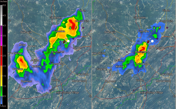
The heavy rain has ended in the downtown area, but continues from north of downtown to Fultondale, over to the Airport, and up AL-75 to center Point. More heavy rain is in the Fairfield and Hueytown areas. It is all moving slowly west.
Radar estimates indicate that a large part of Birmingham received 1 to 2 inches of rain, with the heaviest from the Civic Center to the Norwood area along I-59.
There is a report of people unable to leave their home because of flooding at 17th Avenue and 33rd Street. This corresponds well with the area of heaviest rain on radar. Motorists stranded at 17th Avenue and 27th Street also.
Scanner reports are courtesy of our Skywatcher John Talbot.
An area flood advisory has been issued for parts of Jefferson County until 9:45. This is a level below a flash flood warning, but please remember, turn around, don’t drown!
The storms will weaken now as the sun sets.
Category: Alabama's Weather, Severe Weather


