Update for Alabama/Missouri Game
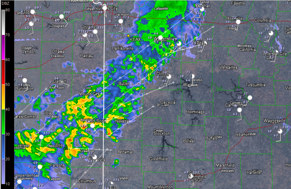
Here is a look at the Pleasant Hill radar (near Kansas City). Columbia MO is near the top right edge of the image. Click on the image to enlarge it.
You can see showers and thunderstorms upstream from Columbia over southeastern Kansas and western Missouri. These storms are not severe, and they have actually been weakening. But the sun is peeing through over Missouri and instability values are starting to creep up a bit in spots. While significant severe weather is not expected, the more heating that we see in that area, the better the chance is that we might see a warning or two.
Extrapolation puts the storms to the southwest over Columbia in about 2-3 hours, or just about kickoff. Off and on showers and storms are likely during the game. Lightning is also likely, so there is a good chance that there will be lightning delays.
The better chance for severe weather in Missouri will come late tonight as a squall line forms ahead of a cold front and pushes east.
Auburn is enjoying good weather in Oxford, and UAB is sweating through a hot and humid Gulf Coast airmass at Houston.
Category: Alabama's Weather, Headlines


