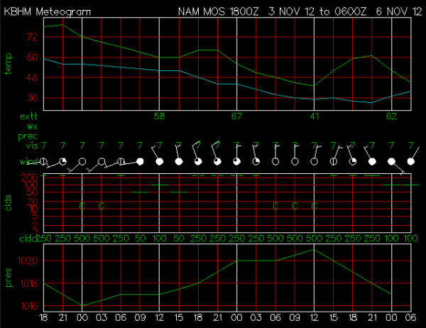
Forecasted Weather Profile
We can get an idea at what we can expect over the next few days, by taking a quick look a simple meteogram. Meteograms are great for profiling weather because they will show you temperature, dew point, pressure, wind and cloud cover profiles all on one image. This meteogram is the forecast from the 18Z NAM MOS for Birmingham. You will notice that the temperature profile will be cooler after today. The cold front off to our northwest will make its way towards us, the pressure will continue to drop until after the frontal passage as well. Winds will remain out of the west-southwest before switching out of the north tomorrow morning, which will help usher in the much cooler weather we can expect to start a new week.
This particular meteogram is from one of the drier model runs from earlier today. Even though not much rain is expected from this model run, cloud cover will certainly be in place tomorrow morning and should last for most of the day. Monday, not as many clouds will be in place, but they will return Monday night and into Tuesday.
Pressure will increase behind the front for a day or so, before it will begin to drop again with a disturbance that will work across the Southeast, bringing in additional clouds and an increased chance for some showers.
Category: Alabama's Weather


