Rain Inching Closer – Mild Weather Ending
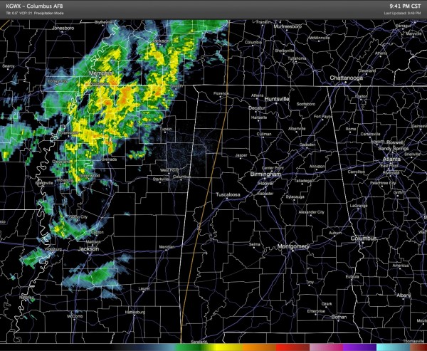
At 9:45 pm, the cold front that we expect to move through Alabama tomorrow was located just west of the Mississippi River at Memphis, TN. The front along with the showers and thunderstorms just ahead of the front was moving just a bit faster than previous forecasts indicated. It appears now that showers and embedded thunderstorms are likely to reach a line from Huntsville to Tuscaloosa by daybreak on Monday. This is not terribly much faster but at least a smidge faster than I described on the morning Weather Xtreme Video.
Here is the radar around 9:45 pm from Columbus, MS.
Interesting temperature change across the front. Just before 10 pm, it was 65 at Birmingham, 69 at Tupelo, 64 with rain at Memphis, 52 at Batesville, AR, and 39 at Harrison, AR. Going further northwest it was in the mid and upper 20s across Kansas. Brrrrr ! ! !
Tomorrow is likely to be one of those days where the temperature does not change much during the day, and might actually fall. Our high is likely to come at midnight, probably the lower 60s. By sunrise or shortly after we should see the rain reach Birmingham with temperatures for the morning and afternoon in the 50s, probably falling. Our low will probably come just before midnight around 40 degrees or so.
-Brian-
Category: Alabama's Weather


