3:30 a.m. Update
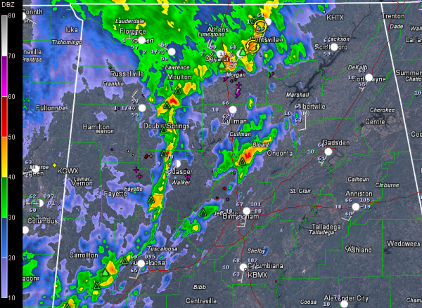
That little mesoscale vortex that we have been tracking all the way from Central Louisiana tonight is in the Huntsville area now.
It is kicking up quite a little fuss, with a good bit of lightning, but nothing severe. Winds gusted to 37 mph at Decatur, and the pressure was rising rapidly after its passage.
Trailing the vortex, a thin line of showers and storms extends across Winston, western Walker, Fayette, Tuscaloosa, southern Pickens and northern Sumter Counties.
There are some stronger storms moving into Sumter County, where instability is better.
Ahead of the line, there was a decent cell in southwestern Blount County.
Still nothing severe or threatening to be severe at this hour.
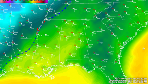
Look at the cold air behind the front, which is near Memphis at this hour. 61F at Greenville MS while it is 28F at Harrison AR!
It remains to be seen whether severe weather will be able to develop this morning across the area with the front still to pull through. The best chances will come late this morning as strong upper level winds punch into the area and the low lifts out to the northeast. While instability is expected to be low, the strong winds aloft could result in damaging winds. Can’t rule out an isolated small tornado as well, but the threat is low.
Category: Alabama's Weather, Severe Weather


