

Active Weather Day Ahead
Brian Peters will be along shortly with a detailed discussion and Weather Xtreme video; here are some notes on what to expect today…
*LOTS OF RAIN: Heavy rain is already in place this morning over Northwest Alabama… see the radar below…
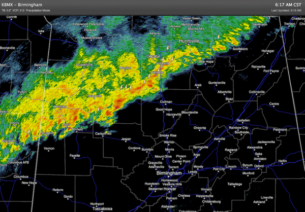
This batch of heavy and and storms will slowly drop southward this morning. The storms are not severe, and severe weather is not expected this morning. But, the rain will be heavy at times.
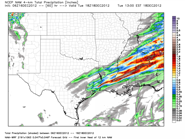
The 4km NAM is projecting 1-2 inches of rain over this part of Alabama through tomorrow morning, and no doubt some spots will get more, potentially leading to some localized flooding problems.
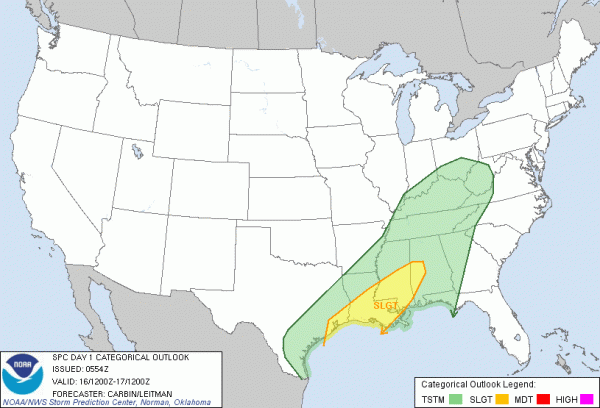
*SEVERE WEATHER? SPC has actually removed most of Alabama from the severe weather threat today; just a a few west-central counties are involved…
However, there seems to be a window for some late night problems over Alabama as shear increases along with the low level jet. Below is the projected radar reflectivity at 4:00 a.m. Monday…
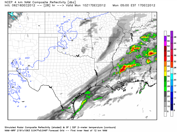
The main window for severe weather will come from midnight tonight until 8:00 a.m. tomorrow, primarily along and south of I-20. This is a fairly marginal threat due to limited instability, but with the projected low level shear a few tornadoes can’t be ruled out, so this will be a night when you want to be sure your NOAA Weather Radio or smart phone app is properly programmed and ready for action.
More details soon…
Category: Alabama's Weather
About the Author (Author Profile)
James Spann is one of the most recognized and trusted television meteorologists in the industry. He holds the AMS CCM designation and television seals from the AMS and NWA. He is a past winner of the Broadcast Meteorologist of the Year from both professional organizations.Subscribe
If you enjoyed this article, subscribe to receive more just like it.


