

Afternoon Update…
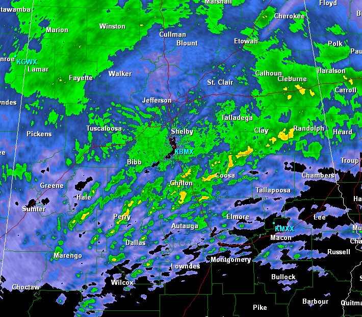
A nice steady rain continues to fall across much of North Central Alabama. Heaviest rain continues to fall from a line near Demopolis to Heflin. Additional showers and thunderstorms are expected to develop along the cold front back off to our west and will be impacting Alabama overnight.
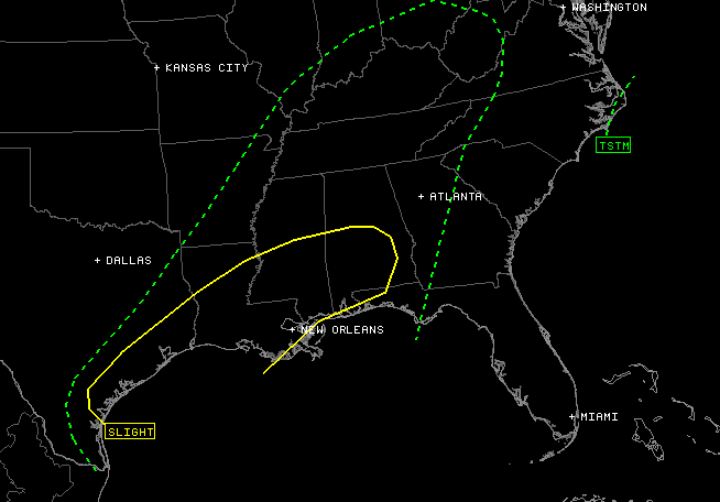
The severe weather threat has lessened across much of North Central Alabama. The latest outlook has trimmed Birmingham and Tuscaloosa out of the risk, but Demopolis, Clanton, Montgomery, Greenville and Mobile remain in it. The rain over our part of the state has help to stabilize the atmosphere. Further south, it hasn’t rained as much and the atmosphere is still unstable. We still expect severe weather across Alabama tonight, as the main upper-level dynamics work through the state. Widespread severe weather is still expected to develop in Louisiana and Mississippi and move towards Alabama.
Category: Alabama's Weather
About the Author (Author Profile)
Macon, Georgia Television Chief Meteorologist, Birmingham native, and long time Contributor on AlabamaWX. Stormchaser. I did not choose Weather, it chose Me. College Football Fanatic. @Ryan_StinnetSubscribe
If you enjoyed this article, subscribe to receive more just like it.


