

Showers and Thunderstorms Increasing
Latest look at the radar shows showers and thunderstorms have began to redevelop across southern Mississippi and southwestern Alabama. This activity will be tracking off to the northeast ans will be expanding in coverage. There is still a chance of severe weather especially in the southern counties of the state. Damaging winds will be the greatest threat.
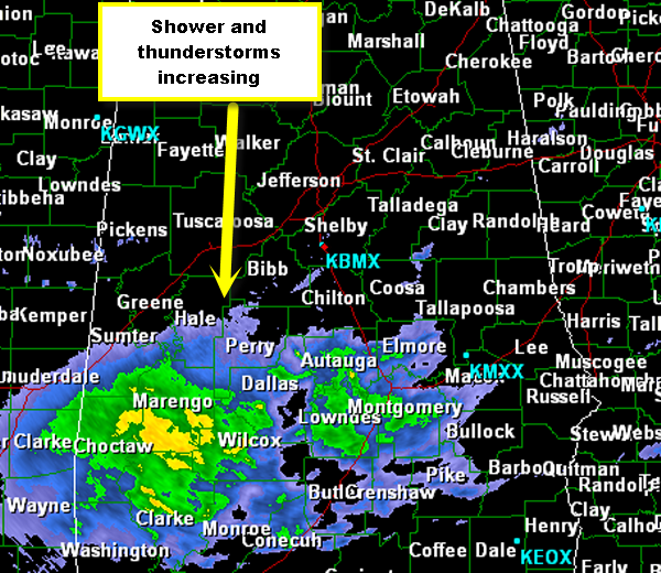
As we look at the simulated radar over the next couple of hours this morning, much of Central Alabama looks to get wet this morning. Heavier activity is expected from Birmingham, Tuscaloosa and Anniston south towards Montgomery.This activity will continue to move northeast through the morning and into the early afternoon.
Category: Alabama's Weather
About the Author (Author Profile)
Macon, Georgia Television Chief Meteorologist, Birmingham native, and long time Contributor on AlabamaWX. Stormchaser. I did not choose Weather, it chose Me. College Football Fanatic. @Ryan_StinnetSubscribe
If you enjoyed this article, subscribe to receive more just like it.


