

Midday Notes….
We are still looking at the potential for a dangerous, high impact severe weather event across Alabama late this afternoon and tonight.
SPC notes they are considering upgrading a part of the moderate risk to a “high risk” at mid-afternoon.
After a review of surface, upper air, and model data… here are some important notes…
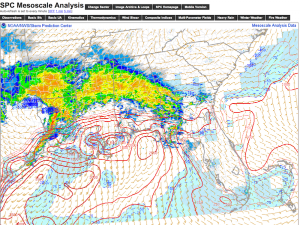
*We are fully aware conditions are cool and wet with stable air over Central Alabama right now. The rain is north of a warm front, that is positioned from near Linden to Greenville to Eufaula. Below this front, dewpoints are in the 60s, the sun is breaking out, and the air is becoming very unstable. This unstable air will surge into Central and North Alabama over the next 4-5 hours. Just because the air is cool and stable where you live now, doesn’t mean it will be that way this evening. It won’t.
*We will delay the main window for severe weather by couple of hours. The primary window is now from 5 p.m. today to 3:00 a.m. tomorrow. The initial threat over West Alabama begins around 5:00, then spreading east. For those of you traveling across the state today, consider completing the trip by 5 p.m. over West Alabama, and by 7 p.m. over the eastern side of the state.
*No change in the threat of long track, violent tornadoes. The main risk is south of I-59/20, and west of I-65 late this afternoon and tonight. Some of the communities in this zone include Livingston, Eutaw, Greensboro, Brent, Marion, Demopolis, Selma, Butler, Monroeville, Camden, and Thomasville…. all the way down to Mobile. This part of Alabama is where the combination of shear and instability will be maximized.
*To the north, severe storms and a few tornadoes are still possible to the Tennessee state line; the main question there is the Tennessee Valley. It could be the unstable air remains south of U.S. 278, but I expect a surge this evening that carries the higher dewpoints all the way to the state line.
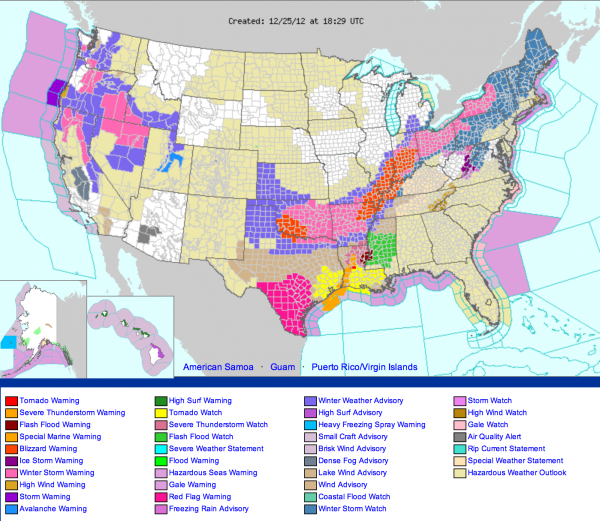
*Amazing to see the blizzard warnings for parts of AR, TN, KY, MO, IL, and IN today. You pick out the strip of heavy snow north and west of Alabama by the warnings…
Bill Murray will keep the blog updated through the afternoon and night; I will have my first update on ABC 33/40 and our live stream at 3:00 p.m.
Category: Alabama's Weather, Severe Weather
About the Author (Author Profile)
James Spann is one of the most recognized and trusted television meteorologists in the industry. He holds the AMS CCM designation and television seals from the AMS and NWA. He is a past winner of the Broadcast Meteorologist of the Year from both professional organizations.Subscribe
If you enjoyed this article, subscribe to receive more just like it.


