

Early Morning Update
Click image to enlarge
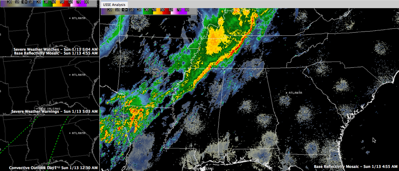
A line of thunderstorms continues to push eastward across northern Mississippi early on this Sunday morning.
They have lots of lightning still, but all have weakened below severe levels as the main dynamics are now to the northeast over the Ohio Valley.
There was a tornado watch for parts of western Tennessee, southern Arkansas, northern Louisiana and northwestern Mississippi until 6 a.m. but it was canceled before its set expiration time.
These storms will work into Northwest Alabama later this morning and then slowly southeastward across West Alabama this afternoon and will affect the I-59 corridor this evening and into the overnight.
A storm or two could become severe briefly this afternoon, but the SPC doesn’t even have a slight risk posted for today for anywhere in the country. The setup just isn’t conducive for severe weather. But keep an ear on a severe weather source just in case later today.
The biggest stories will be 2-3 inches of rain between now and early Wednesday and a turn to sharply colder.
Category: Alabama's Weather, Severe Weather
About the Author (Author Profile)
Bill Murray is the President of The Weather Factory. He is the site's official weather historian and a weekend forecaster. He also anchors the site's severe weather coverage. Bill Murray is the proud holder of National Weather Association Digital Seal #0001 @wxhistorianSubscribe
If you enjoyed this article, subscribe to receive more just like it.


