

Evening Update…
COLD, RAW, WET, ICY… Not a night for man nor beast…
ICING ISSUES: The NWS offices in Huntsville and Birmingham have expanded the “winter weather advisory” a bit… these counties are included:
Lamar, Fayette, Walker, Winston, Marion, Cullman, Franklin, Colbert, Lauderdale, Lawrence, Limestone, Morgan, and Madison.
This is where temperatures will hover around freezing through the night. Thankfully, the infrastructure is pretty warm and we don’t expect a major ice storm, but there is clearly some risk of patchy bridge icing overnight. If you have to travel in this part of Alabama, be careful on those bridges and overpasses. Black top roads will stay just wet.
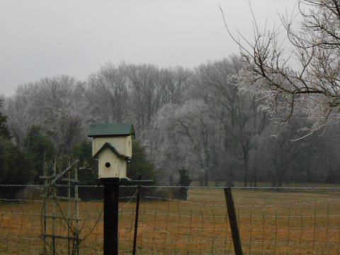
Below is a shot of ice in the trees near Russellville in Franklin County before the sun set today…
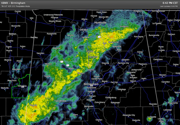
FLOODING ISSUES: We received a report from Cullman County EMA indicating reports of widespread flooding of low lying roadways across Cullman County. Flooding remains a concern in the broad area from Aliceville to Guntersville, where flood watches remain in effect. Remember, turn around, don’t drown if you come across water running across a roadway.
The next forecast issue comes Thursday when a cold core upper low moves across Alabama… we will get new model data in the next few hours and we will review the snow potential. Scroll down for the afternoon discussion, or see the Weather Xtreme video for details.
Category: Alabama's Weather
About the Author (Author Profile)
James Spann is one of the most recognized and trusted television meteorologists in the industry. He holds the AMS CCM designation and television seals from the AMS and NWA. He is a past winner of the Broadcast Meteorologist of the Year from both professional organizations.Subscribe
If you enjoyed this article, subscribe to receive more just like it.


