

Tuesday Night/Wednesday Severe Weather Threat
Let’s look at the severe weather situation for Alabama…
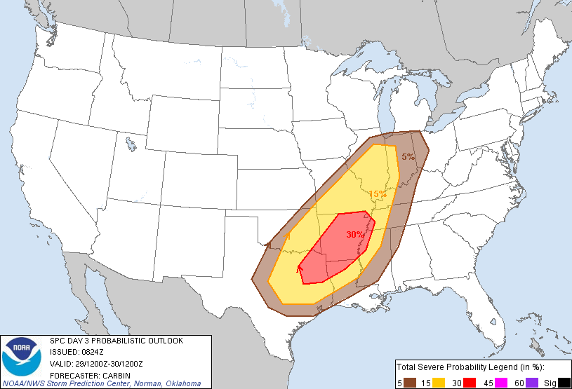
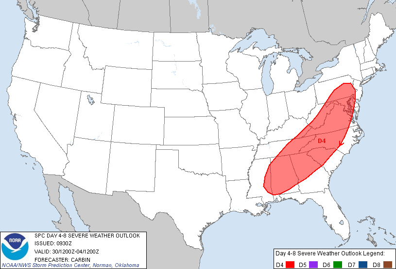
Below are the SPC convective outlooks for Tuesday (Day 3), and Wednesday (Day 4)…
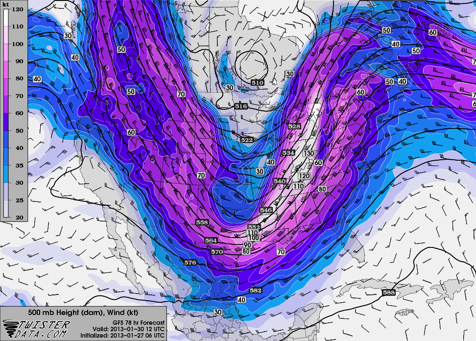
Below is a look at the 500 mb (18,000-20,000) trough supporting the event; note the wind speeds are well over 100 knots on the eastern side of the trough axis…
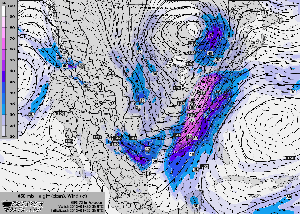
And, here is the low level jet (850 mb)… velocities are well over 50 knots…
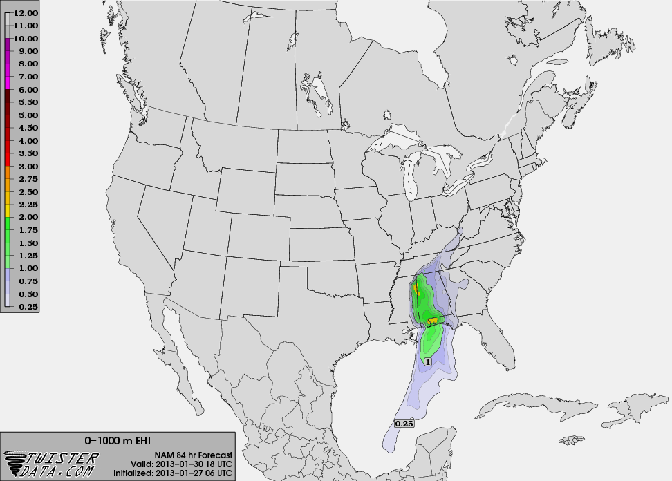
And, the EHI (energy helicity index) valid at 12:00 noon Wednesday from the NAM…
What does it all mean? Here are some thoughts now…
STORM ENVIRONMENT: Temperatures here on Tuesday could soar into the mid 70s ahead of the storm system; both the GFS and the NAM are printing a high of 74 degrees for Birmingham (close to the record high of 78 in 2002). Of historical note, the warmest January temperature on record for Birmingham is 81 degrees, on January 10, 1949. Almost all of our January heat records were set in the 1930s and 1940s. Dewpoints are expected to surge into the low 60s by Tuesday evening, providing an unstable airmass.
TIMING: The main window for severe weather in Alabama will come from about 3:00 a.m. through 5:00 p.m. Wednesday. There are some pretty big discrepancies involving the timing from the various models; the GFS wants to push a line of storms through here from midnight Tuesday through 8:00 a.m. Wednesday, while the NAM and ECMWF are slower, suggesting a daytime event Wednesday. Thus, the long window for severe weather at this point; once the models are in better agreement we will be able to trim this down and be more specific.
THREATS: Clearly the biggest risk is a line of severe storms with potential for damaging, straight line winds. This line will race across Alabama with strong dynamic forcing, and has the potential to bring widespread winds of over 40 mph, with severe criteria winds in some places (58 mph or higher). With the forecast LCL heights and helicity values, isolated tornadoes will be possible in any discrete cells that form ahead of the line. Forecast model soundings show a capping inversion early Wednesday morning; hopefully if the squall line (QLCS) comes through early in the day (when the air is more stable) it will limit the tornado threat, even if that does happen we sure can’t rule out a tornado or two.
IS THIS EVENT LIKE???? Long time readers know we don’t comment on questions asking if this is like April 27, 2011… please read this post.
IS IT ODD TO HAVE TORNADOES IN JANUARY? Not really. While it is not in a “classic” severe weather period like spring and fall, we have had tornadoes many times in the past during the month of January.
No need to be anxious over this, just have a way of getting warnings if they are needed, and have a severe weather action plan. See this simple, three step process on the 33/40 site.
Brian will be along shortly with a full discussion a
Category: Alabama's Weather
About the Author (Author Profile)
James Spann is one of the most recognized and trusted television meteorologists in the industry. He holds the AMS CCM designation and television seals from the AMS and NWA. He is a past winner of the Broadcast Meteorologist of the Year from both professional organizations.Subscribe
If you enjoyed this article, subscribe to receive more just like it.


