

Severe Threat Increasing South Central Alabama into Georgia
Jim Stefkovich at the NWS Birmingham sent a note along to voice their concern about the increasing potential for severe weather over South Central and Southeast Alabama up into the Atlanta area. He posted this excerpt from the latest SPC mesoscale discussion.
POTENTIAL FOR INCREASING CONVECTIVE ORGANIZATION/EASTWARD ACCELERATION AND SEVERE WEATHER POTENTIAL APPEARS TO EXIST EARLY THIS AFTERNOON ALONG A CORRIDOR FROM MONTGOMERY AND TROY AL THROUGH AREAS NEAR AND NORTHEAST OF THE ATLANTA METROPOLITAN AREA. THIS INCLUDES THE RISK FOR TORNADOES…AS WELL AS DAMAGING WIND GUSTS.
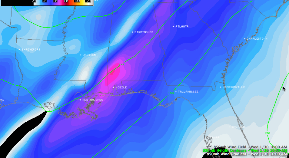
A key component of the concern is a developing low level jet at 850 mb or 5,000 over southern Alabama. Winds are over 70 knots in the jet now over Southwest Alabama. It will be migrating northeastward, pumping in instability and increasing wind shear.
Category: Alabama's Weather, Severe Weather
About the Author (Author Profile)
Bill Murray is the President of The Weather Factory. He is the site's official weather historian and a weekend forecaster. He also anchors the site's severe weather coverage. Bill Murray is the proud holder of National Weather Association Digital Seal #0001 @wxhistorianSubscribe
If you enjoyed this article, subscribe to receive more just like it.


