

The 1985 Northwest Alabama Winter Storm
Click image to enlarge
On Friday, February 1, 1985, the forecasts were dire for the Birmingham area and much of Central Alabama. It was expected to be the biggest winter storm since the 1982 ice storm. Winter storm warnings were issued for the area north of a line from Livingston to Birmingham to Anniston.
Weather reports called it a dangerous storm with two inches of freezing rain and snow mixed expected. Here is an except of a statement from the National Weather Service:
A DAMAGING ICE STORM IS AHEAD FOR NORTHWEST ALABAMA. THE NATIONAL WEATHER SERVICE EMPHASIZES THIS WILL BE AN ICE STORM OF DAMAGING PROPORTIONS. THERE WILL BE POTENTIAL MAJOR DAMAGE TO TREES AND UTILITY LINES AND NUMEROUS HIGHWAYS WILL BECOME IMPASSABLE. THERE WILL LIKELY BE NUMEROUS AND EXTENDED POWER OUTAGES. EARLY THIS MORNING…POWER LINES WERE ALREADY FALLING IN SOUTHERN LAWRENCE COUNTY AND ON MONTE SANO MOUNTAIN IN HUNTSVILLE.
Trees were expected to lose limbs and power lines were going to fall. Advice was to bundle up, stock up on flashlights, batteries and candles. Stay indoors and get to know your family better.
Low pressure was predicted to push east northeastward along the Gulf Coast, in a situation familiar to thousands of Alabama snow fans, as cold high pressure to the northeast stubbornly blocked its progress. The warm, moist air would be lifted over the dome of high pressure, leading to overrunning precipitation that would fall as a wintry mix.
The icy mix did materialize early in the day over Northwest Alabama and as rain fouled the morning rush hour in Birmingham, forecasters warned that temperatures would fall during the day, turning the rain to freezing rain and sleet and eventually some snow. An icy coating began to form on trees as far south as northern Jefferson County.
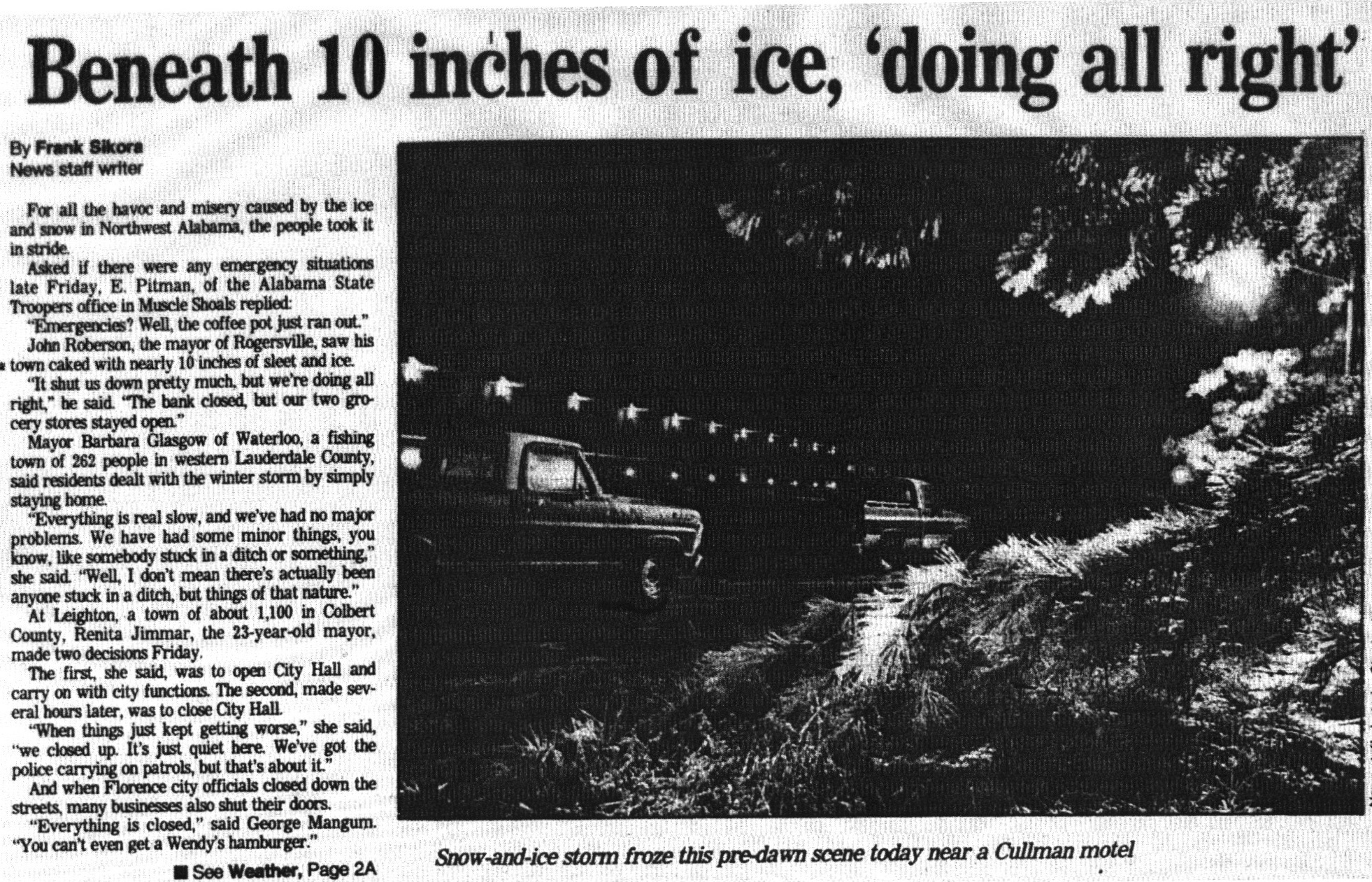
By late morning, up to six inches of sleet and freezing rain had fallen over Northwest Alabama over parts of Lauderdale, Colbert, Franklin and Marion Counties, paralyzing the area. Schools and roads were closed.
By afternoon, businesses were closing and people were going home early in Birmingham, remembering the bad situation during the January 1982 ice storm which trapped thousands on area highways. The expectation was that sleet and freezing rain would begin before dark.
The storm did pull its punch for much of Central Alabama, but Freezing rain did accumulate on trees and power lines in the Birmingham area, putting hundreds of thousands of people in the dark. The winter storm warning was dropped early Saturday morning. Older people will remember the alert that replaced the winter storm warning: the traveler’s advisory.
But up to eleven inches of sleet and freezing rain covered parts of Northwest Alabama. Roofs collapsed on three businesses in the Florence area and numerous carports and awnings fell victim to the weight of the sleet and snow. For the first time in recorded history, roads were closed in the Florence area. Most Huntsville television stations were off the air. People were stranded on I-65 north of Cullman for a time Friday evening. It was the worst winter storm since 1963 in Northwest Alabama.
US-78 northwest of Birmingham was a skating rink with numerous accidents being reported. An ambulance carrying wreck victims to Carraway Hospital overturned, injuring the crew.
Four people died as a result of the winter storm in Alabama.
Category: Met 101/Weather History
About the Author (Author Profile)
Bill Murray is the President of The Weather Factory. He is the site's official weather historian and a weekend forecaster. He also anchors the site's severe weather coverage. Bill Murray is the proud holder of National Weather Association Digital Seal #0001 @wxhistorianSubscribe
If you enjoyed this article, subscribe to receive more just like it.


