

A Nearly Invisible Cold Front
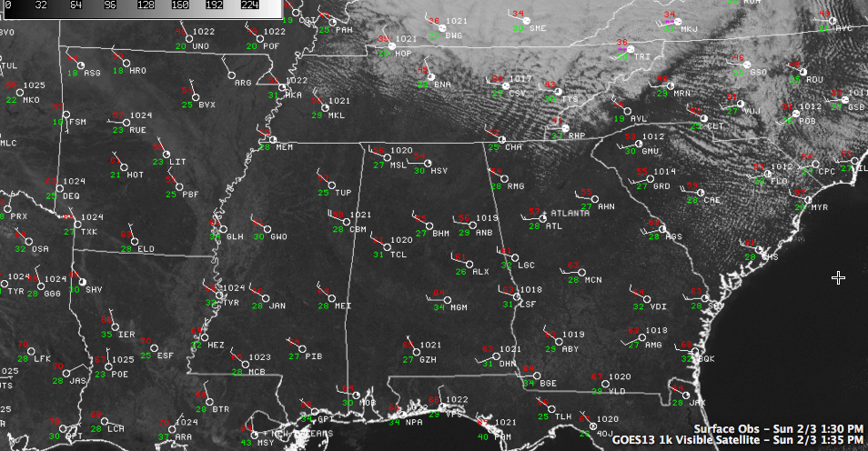
You can’t see it on the radar. You can’t see if on satellite. You can’t see it in the dewpoints. You can’t even see it in the temperatures, but you can certainly see it in the wind barbs on the weather map. It passed Birmingham between 9:30 and 10:30 a.m., and the wind vane at the Airport recognized it, shifting from a southwesterly to a northwesterly direction.
And it has become quite breezy behind the front, with northwesterly winds averaging 15-20 mph and gusting to over 25 mph at time.
Skies are completely clear, as are radars. There is some higher low level moisture just to our north over Tennessee, and you can see it in the visible satellite, which shows a heavy deck over much of Kentucky which thins into a healthy zone of stratocumulus cloud streets which clearly display the northwesterly flow.
Believe it or not, temperatures in the I-20 corridor at 1 p.m. today weren’t a whole lot different than those of the same time yesterday. At 1 p.m. on Saturday it was 51F at Birmingham. Today, it was 56F, but it felt much more comfortable, thanks to what is a strengthening winter sun.
Everyone drops to near or just below freezing tonight.
Clouds will be on the increase tomorrow and showers will arrive tomorrow night. Areas south of Birmingham will see the higher rain chances since they will be closer to a surface low that is expected to develop and track along the Gulf Coast. Rainfall amounts will be around a tenth of an inch in the I-20 corridor, with higher amounts the further south that you go.
Category: Alabama's Weather
About the Author (Author Profile)
Bill Murray is the President of The Weather Factory. He is the site's official weather historian and a weekend forecaster. He also anchors the site's severe weather coverage. Bill Murray is the proud holder of National Weather Association Digital Seal #0001 @wxhistorianSubscribe
If you enjoyed this article, subscribe to receive more just like it.


