

Showers Tomorrow; Sunshine Saturday
**No afternoon Weather Xtreme video today… on the road to Tuscaloosa where we begin Storm Alert 2013 tonight at Holt High School**
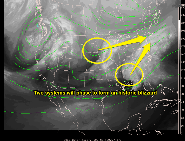
Clouds linger across Alabama this afternoon, and some rain is still falling on the eastern side of the state, but the bulk of the rain is now east of the state as short wave energy begins to move away. Satellite images this afternoon show the wave that moved through here earlier today, and a northern stream wave, that will phase to create an historic blizzard over the Northeast U.S. tomorrow and Saturday….
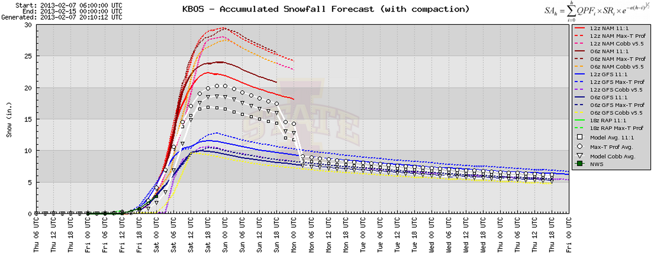
Just for fun… here is the model snow projection for Boston…
Showers are possible tomorrow morning across Alabama with a passing cold front, then the sky will clear late tomorrow and tomorrow night as drier air moves into the state. I would not be surprised if we have some more dense fog late tomorrow night into early Saturday morning.
OUR WEEKEND: Once the morning fog burns off, Saturday looks like a great day, with ample sunshine and a high in the low 60s. But, on Sunday, clouds return along with an increasing south wind. Showers will develop during the afternoon Sunday, then becoming widespread Sunday night.
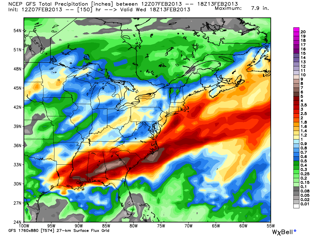
We still have the potential for heavy rain at times Sunday night through Tuesday, with rain amounts of 1 to 3 inches likely, along with isolated amounts to 4 inches. Flooding problems can’t be ruled out, and a strong storm or two is certainly possible.
Below is the GFS accumulated precipitation projection through Wednesday of next week…
Colder and drier air begins to arrive Wednesday.
STORM ALERT 2013 OPENS TONIGHT: Our annual severe weather awareness tour across Alabama kicks off tonight; we will be at Holt High School tonight; the show begins at 6:30. We will share lessons learned after the April 27, 2011 generational tornado event, along with other amazing weather stories. Learn how to keep your family safe during severe weather, and have a chance to win some cool prizes as well. Here is the entire Storm Alert tour schedule for the year…
February 7 Holt – Holt High School
February 12 Jasper – CHS Community Building
February 21 Clanton – Jeff State Performing Arts Center
February 26 Ohatchee – Ohatchee High School
February 28 Clay – Clay/Chalkville High School
WEATHER BRAINS: Don’t forget you can listen to our weekly 90 minute netcast anytime on the web, or on iTunes. This is the show all about weather featuring many familiar voices, including our meteorologists here at ABC 33/40.
CONNECT: You can find me on all of the major social networks…
We will get back to the “two a day” video schedule tomorrow. I hope to see many of you at Holt High School tonight!
Category: Alabama's Weather
About the Author (Author Profile)
James Spann is one of the most recognized and trusted television meteorologists in the industry. He holds the AMS CCM designation and television seals from the AMS and NWA. He is a past winner of the Broadcast Meteorologist of the Year from both professional organizations.Subscribe
If you enjoyed this article, subscribe to receive more just like it.


