

A Gorgeous Sunday
A gorgeous Sunday is in progress across all of Alabama. The only clouds that can be found in the 67 counties of the state are across southern Mobile and Baldwin Counties. After that, traveling northwest, you would make it to Farmington, Missouri before finding another one.
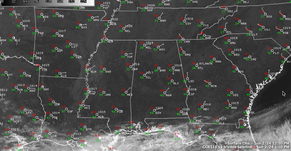
Temperatures have warmed nicely across Central Alabama into the lower 60s in the I-20 corridor by 1 p.m. The temperature at Montgomery was rapidly approaching 70F at Montgomery. Alexander City had already made it there.
Clouds will start to increase tonight and it should be cloudy by the time you wake up Monday morning. Temperatures overnight will stop in the 40s, thanks to the increasing clouds.
Rain and thunder will arrive on Monday ahead of a northward moving warm front. The morning run of the GFS is a little slower with the arrival of the rain in Central Alabama, delaying it until afternoon. The European is still on track for a morning arrival though. Pretty soon we will see the whites of the system’s eyes and will know.
In any case, more rain is headed our way. Still expecting about an inch of rain in the I-59 corridor, with lower amounts to the northwest and higher amounts to the southeast.
As Brian pointed out a little earlier, we are in a pretty wet February. Montgomery is heading for the possibility of recording their wettest February ever. Don’t even talk to people in Geneva in Houston County. Indications are some spots there have seen as much as 20 inches of rain in the past 30 days!
Category: Alabama's Weather
About the Author (Author Profile)
Bill Murray is the President of The Weather Factory. He is the site's official weather historian and a weekend forecaster. He also anchors the site's severe weather coverage. Bill Murray is the proud holder of National Weather Association Digital Seal #0001 @wxhistorianSubscribe
If you enjoyed this article, subscribe to receive more just like it.


