

Wintry Start To March
**I am serving as the emcee of the Red Cross Heroes Breakfast this morning in Homewood… Brian Peters will be along shortly with a new Weather Xtreme video and discussion… this is just an early peek of weekend weather highlights**
Not much change in the overall thinking… very cold air settles into the state over the weekend thanks to this deep upper trough…
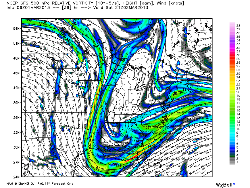
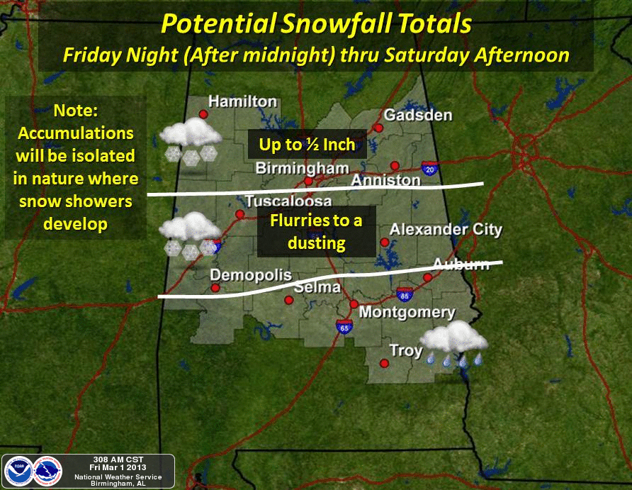
Snow showers are likely across the northern half of Alabama late tonight and tomorrow. They will be scattered, but some spots could see some light accumulation on grassy areas… below is the projected snow amounts from the NWS, and their map looks good to me…
We won’t get out of the 40s today, and tomorrow’s high will be only in the low 40s with an icy north wind. Tomorrow will be a windy, blustery, cold March day. And, lows will be well down in the 20s early Sunday and Monday morning.
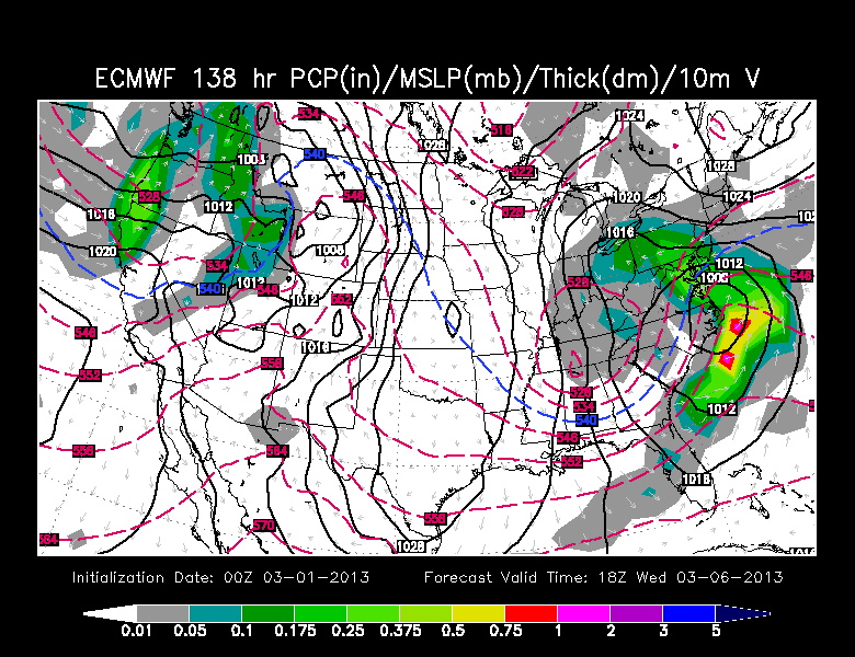
NEXT WEEK: Showers return to Alabama on Tuesday of next week… we have seen some hint of a little snow on the back side of this one Tuesday night or Wednesday morning, but the latest GFS and ECMWF runs are drier. Below is the ECMWF look for Wednesday. Colder, but mostly dry with only flurries…
Again, thanks to Brian for covering the video and full discussion… this has been a very, very busy week. I have stops today at Trinity United Methodist Church in Homewood, and Wylam K-8 school in Birmingham… then I am on to the BJCC for live weather from an event there at 4, 5, and 6:00. I should have time to crank out an afternoon Weather Xtreme video between all of this. Enjoy the day!
Category: Alabama's Weather
About the Author (Author Profile)
James Spann is one of the most recognized and trusted television meteorologists in the industry. He holds the AMS CCM designation and television seals from the AMS and NWA. He is a past winner of the Broadcast Meteorologist of the Year from both professional organizations.Subscribe
If you enjoyed this article, subscribe to receive more just like it.


