

Midday Update
After a review of the 12Z model data… looks like we will need to hit the tornado threat a little harder for tomorrow, especially over the eastern two-thirds of Alabama…
Below is the 4km (high resolution) NAM output valid at 4 p.m. tomorrow…
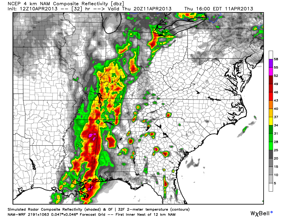
Note the potential for discrete cells ahead of the main squall line. These storms will have the potential for a few tornadoes based on the new projected wind profiles.
I will have a full discussion and Weather Xtreme video by 4:00… but here are the important points…
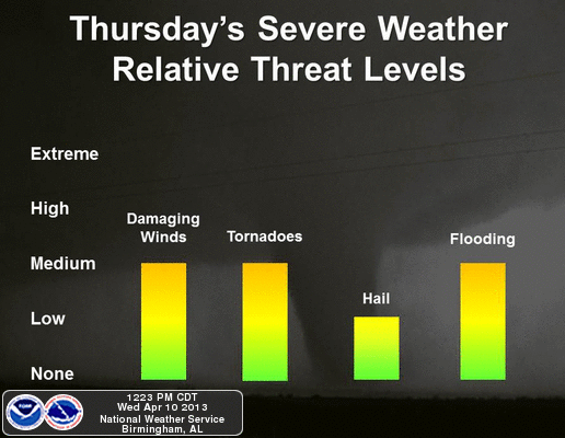
*All modes of severe weather will be possible across Alabama tomorrow… below is a graphic prepared at midday by the NWS Birmingham
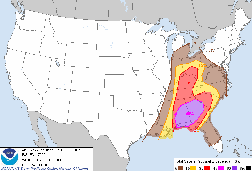
*SPC has raised a 45 percent probability of severe weather for parts of Alabama tomorrow afternoon… meaning a “moderate risk” will be needed… highest severe weather probabilities are south of I-20, and east of I-65.
*Storms should impact places in West Alabama like Haleyville, Vernon, Fayette, Hamilton, Jasper, Tuscaloosa, Eutaw, and Greensboro from 11:00 a.m. until 3:00 p.m.
Then, the risk moves east, and from 3:00 until 6:00 p.m. cities like Birmingham, Cullman, Brent, Oneonta, Cullman, Clanton, and Pell City.
And, the biggest risk from 6:00 until 9:00 p.m. will be for communities like Anniston, Gadsden, Ashland, Centre, Heflin, and Roanoke, in East Alabama.
Again… look for a detailed update a little later this afternoon along with a fresh Weather Xtreme video…
Category: Alabama's Weather
About the Author (Author Profile)
James Spann is one of the most recognized and trusted television meteorologists in the industry. He holds the AMS CCM designation and television seals from the AMS and NWA. He is a past winner of the Broadcast Meteorologist of the Year from both professional organizations.Subscribe
If you enjoyed this article, subscribe to receive more just like it.


