

April Showers
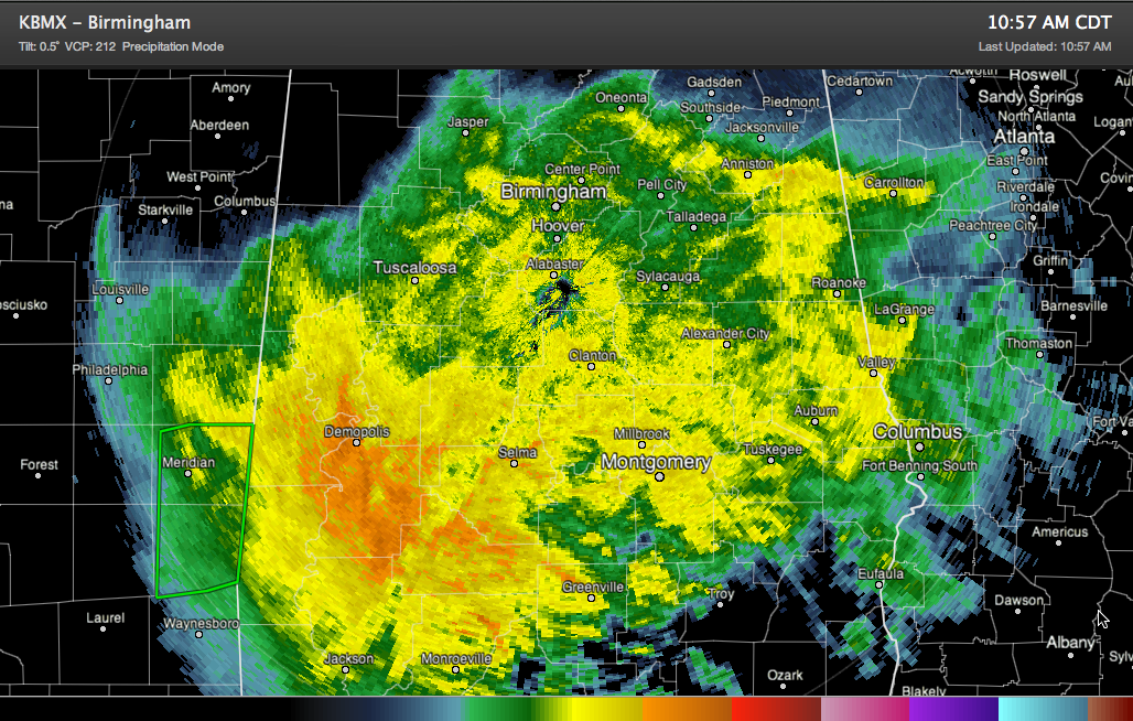
A large area of rain had over overspread the southern two thirds of Alabama by late morning, with strong to severe thunderstorms along the coast around Mobile and Baldwin Counties. The rain has steady but generally light across the northern periphery of the rain mass, but some heavier rain was not too far to the south over West Central and South Central Alabama in places like Livingston: Demopolis, Linden, Uniontown and Marion. This heavier rain area will spread northeast through the afternoon, affecting areas generally south, southeast and east of Birmingham.
RAINFALL AMOUNTS: The places that see the heavier rain will see around an inch of rain through this afternoon, with some amounts in excess of two inches. As much as three inches will be the average along the coast, where the big thunderstorm are roaming. Further north, in the I-20 corridor, one quarter to one half inch amounts will be common. North of I-20, amounts will taper off to less than an tenth of an inch.
BACK EDGE OF THE RAIN: The heaviest rain will be east of Tuscaloosa by 1:30 p.m., east of the Jefferson/Shelby County areas by 2:30 p.m. and out of Anniston by 3:30. Behind the heaviest rain will be intermittent light showers. The end of the rain should be east of I-65 by 9 p.m. and out of Alabama by midnight tonight. Lows tonight will be in the 50s after our daytime readings in the 60s. A few places outside the main rain area might hit 69F this afternoon.
THE CULPRIT: The source of the wet weather is a 1008 millibar surface low east of Grand Isle, Louisiana at the lunch hour. It is moving east northeast. Ahead of it, Gulf moisture was being lifted up and over the airmass across the Deep South, resulting in the big rain area. Along the coast, it was trying to push a warm front on shore, hence the thunderstorms.
SEVERE WEATHER: Severe weather today is limited to coastal sections of Alabama and northwestern Florida. A tornado watch is in effect for the Florida Penahandle. There have already been severe thunderstorm warnings and even a couple of tornado warnings from Louisiana to Baldwin County here in Alabama. Expect more through the afternoon hours. Thunder might be heard as far north as Eutaw, Calera and Ashland, but no severe weather will occur in Central Alabama. Our next chance of severe weather will come late Thursday into Friday.
Category: Alabama's Weather
About the Author (Author Profile)
Bill Murray is the President of The Weather Factory. He is the site's official weather historian and a weekend forecaster. He also anchors the site's severe weather coverage. Bill Murray is the proud holder of National Weather Association Digital Seal #0001 @wxhistorianSubscribe
If you enjoyed this article, subscribe to receive more just like it.


