

Race Weekend Update
An update for NASCAR fans…
THIS AFTERNOON: The rain so far today over much of Alabama has been a no-show, but we note areas of light rain developing now over East Alabama, and over Talladega County. So, a few periods of light rain are possible between now and sundown. Temperatures are in the low 70s now.
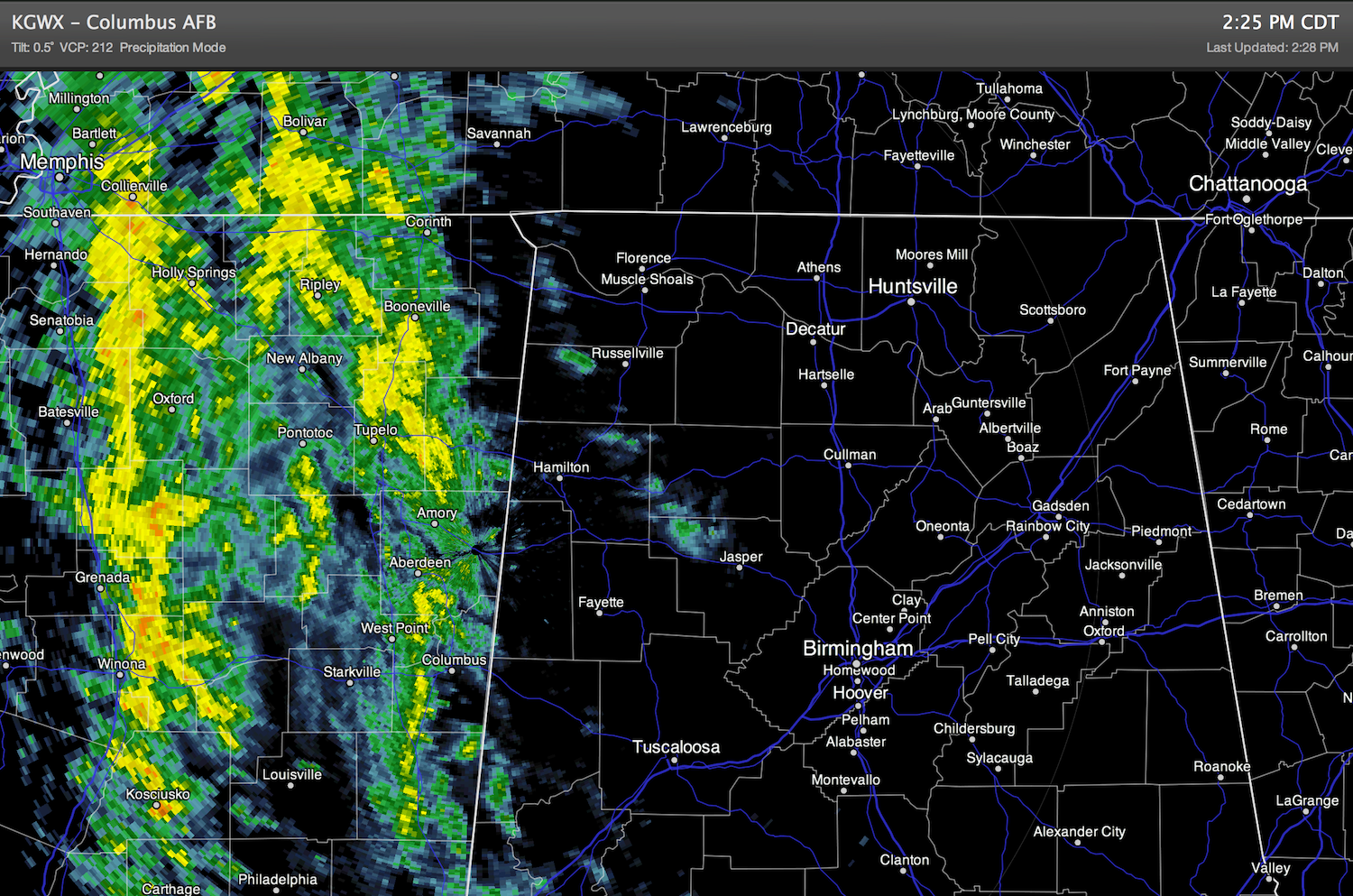
TONIGHT: A large organized mass of moderate rain will move into East Alabama tonight… especially after 9:00 p.m. Around one inch of rain is likely from about 9:00 tonight through mid-morning tomorrow. No severe weather, and probably no thunder. Just a soaking rain. See the current radar below and the rain mass that is moving into West Alabama now.
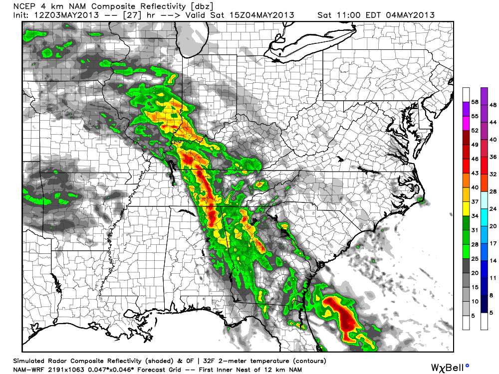
TOMORROW: The latest 4km high-res NAM model shows the rain ending at the Superspeedway in the 10-11 a.m. time frame…
The sun should break out tomorrow afternoon with only a small risk of a stray shower for the Aaron’s 312.
We should note tomorrow will be a very cool May day… the high will be only in the upper 50s; we expect a record low maximum temperature for May 4.
SUNDAY: The early morning hours will be cold; the low around the track will be near 40 degrees… again right at record levels. One or two thermometers might even reach the upper 30s. The firewood guys will be happy.
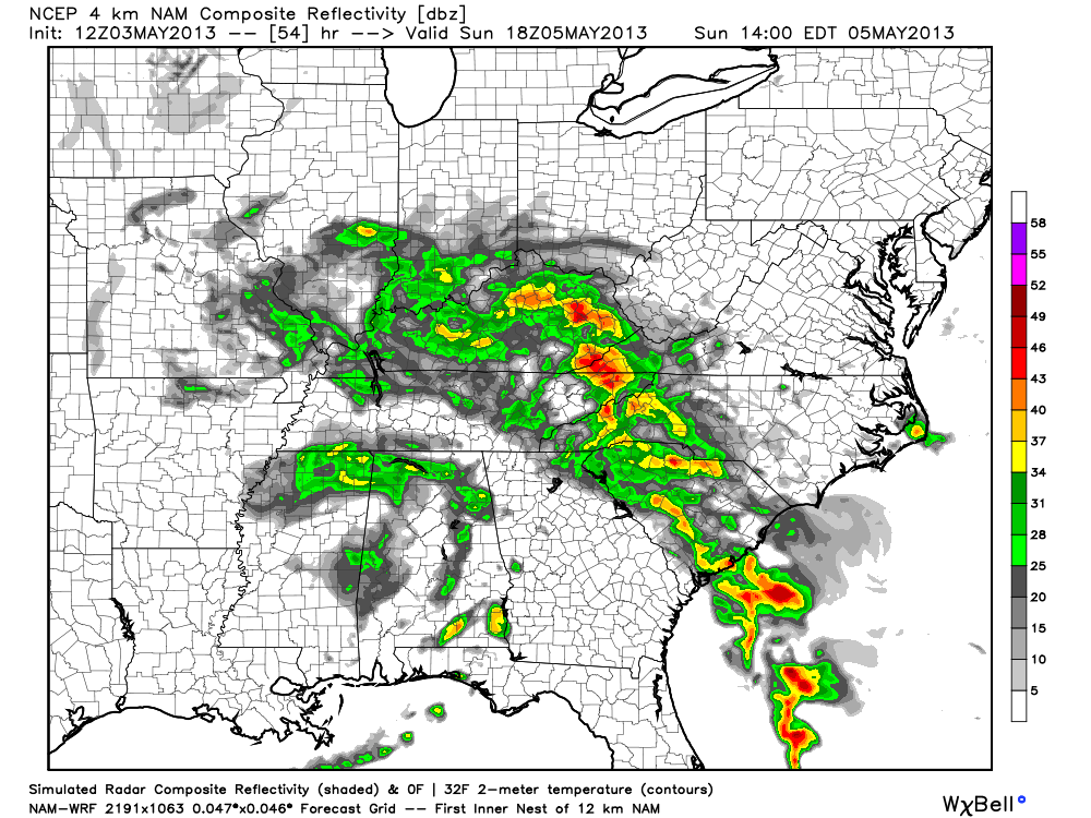
A cold core upper low will move right over the Superspeedway Sunday afternoon, meaning showers are possible at just about any time during the day. Below is the high res NAM valid at 1:00 p.m. CT Sunday… showing showers rotating around the upper low near the Superspeedway…
I think they get the race in Sunday, but one or two rain delays are likely. And, once again the day will be amazingly cool for early May with a high only around 60 degrees.
One more note… due to the very cold air aloft over Alabama Sunday, the showers could produce some small hail, or graupel (soft hail)… even with no thunder or lightning.
We will post updates here as needed through the weekend.
Category: Alabama's Weather
About the Author (Author Profile)
James Spann is one of the most recognized and trusted television meteorologists in the industry. He holds the AMS CCM designation and television seals from the AMS and NWA. He is a past winner of the Broadcast Meteorologist of the Year from both professional organizations.Subscribe
If you enjoyed this article, subscribe to receive more just like it.


