Storms Building into Blount, Etowah
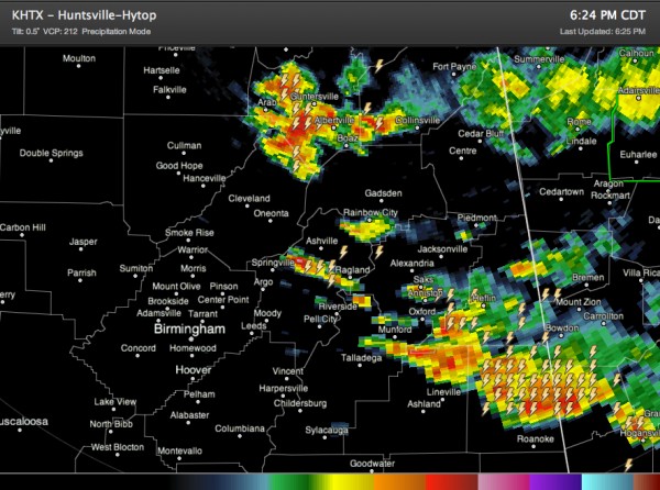
Storms continue to slowly build southwestward this evening over Northeast Alabama into more unstable air to the southwest, aided by a cold pool of air aloft that is edging in from Georgia.
The storm over Marshall County has gotten quite strong with torrential rain, the possibility of small hail and strong gusty winds. It is not severe, however.
It is building back into northeastern Blount County, near Snead and Susan Moore. It will push south and southeast into Etowah County, as well as eastern Blount and across much of St. Clair County. Be alert to any flooding that develops, especially given all of the extreme rains that occurred on Saturday.
Other storms have grown quickly over St. Clair County between Ashville and Springville.
Strong storms have moved out of Calhoun and Cleburne Counties, pushing into Clay and Randolph Counties. They are not severe, but also have lot of torrential rain, lightning and even the possibility of some small hail.
Category: Alabama's Weather, Severe Weather


