

Showers and Storms Developing
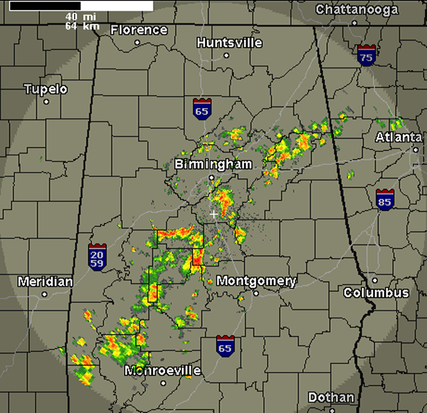
Over the last few hours, we have seen numerous showers and now a few thunderstorms develop over central and southwest Alabama. This activity is tracking off to the northeast and will last through out the day as a warm, moist and soupy air mass is in place. It is not taking much to get these showers and storms to develop. Outflow boundaries from yesterday’s activity as well as a trough pushing through the upper-levels is providing just enough uplift in areas. Severe weather is not expected today, but you can expect intense rain and lightning with this activity.
The most intense activity currently is across portions of Shelby, Chilton and Bibb Counties. With such an unstable air mass in place, any location could see showers and storms today.
Category: Alabama's Weather
About the Author (Author Profile)
Macon, Georgia Television Chief Meteorologist, Birmingham native, and long time Contributor on AlabamaWX. Stormchaser. I did not choose Weather, it chose Me. College Football Fanatic. @Ryan_StinnetSubscribe
If you enjoyed this article, subscribe to receive more just like it.


