

Optimistic Outlook for Tonight?
It is a cool and breezy Independence Day across Central Alabama.
According to Jody Aaron at the NWS, the current reading of 77F at BHM has surpassed the high of 76F on July 4th in 1976, which is our benchmark coolest Independence Day.
A large mass of rain covers East Central and Southeast Alabama, but it is translating northeast and even a little east at this hour.
There are heavy showers over Northwest Alabama from Pickens County through Lamar and Fayette and into Marion and Winston Counties.
In between, only light showers are falling.
Only .17 inches of rain at the Birmingham Airport so far. Southeasterly winds are averaging near 10 mph. It is quite pleasant with the cool temps.
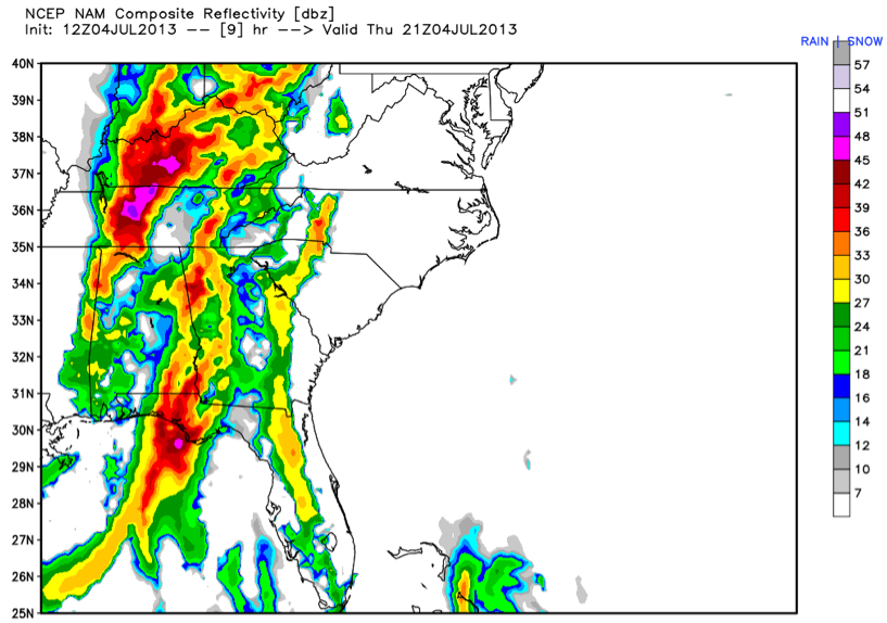
Looking at the output from the North American Mesoscale model, I have an optimistic outlook for tonight’s fireworks displays in most communities. For much of the I-20/59 corridor, scattered showers will continue through 4 p.m. if you trust the simulated radar output.
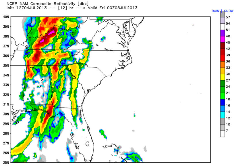
The simulated radar for three hours later, at 7 p.m., shows even fewer showers. This trend could spell increasingly dry condition for the shows, which generally kick off at 9 p.m.
By 10 p.m., the forecast radar looks even better.
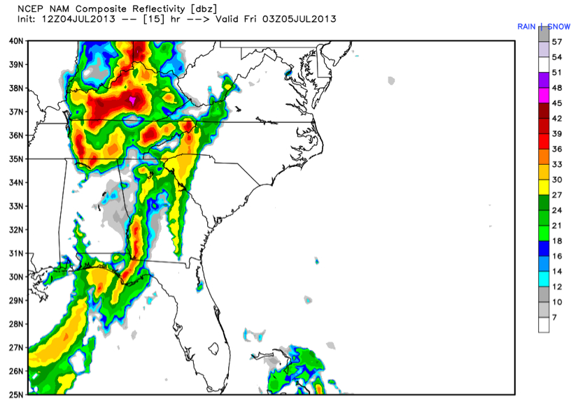
This spells good news for communities south of US-278. It is a model, so it has to be taken with a grain of salt, but we will keep our fingers crossed and an eye on the radar.
Category: Alabama's Weather
About the Author (Author Profile)
Bill Murray is the President of The Weather Factory. He is the site's official weather historian and a weekend forecaster. He also anchors the site's severe weather coverage. Bill Murray is the proud holder of National Weather Association Digital Seal #0001 @wxhistorianSubscribe
If you enjoyed this article, subscribe to receive more just like it.


