

A Soaker of a Saturday
A trough over the eastern sections of the country continues to allow an upper-level low to sit in spin over portions of the Mid-Mississippi Valley. The Bermuda High off the East Coast is strengthening. The wind field between them has allowed a plume of moist air to develop. This highway of moisture has entrenched itself across the state and continues to be the main culprit behind the tropical rains falling across Alabama. It seems like we will never see the end of it. Moisture continues to lift north from the Gulf today and so does the widespread shower and thunderstorm activity. It looks as though most of the state will see another day of soaking rains. The flash flood watch remains in effect through tomorrow, and flash flood warnings can be issued at anytime through the day. Tropical downpours can add up quickly and many areas across the state have seen several inches of rain the past few days. Several more inches are likely and in some localized areas, if under a more intense rain band, could see 4-6 inches.
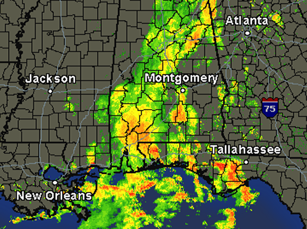
As we look at the regional radar, widespread showers and thunderstorm activity continue to head north from the Gulf. The more intense rain is along the Gulf Coast as well as portions of southwest Alabama. This activity will continue to lift north over the state through out the day. Make sure you have the rain gear handy as it will certainly be a very wet day.
Category: Alabama's Weather
About the Author (Author Profile)
Macon, Georgia Television Chief Meteorologist, Birmingham native, and long time Contributor on AlabamaWX. Stormchaser. I did not choose Weather, it chose Me. College Football Fanatic. @Ryan_StinnetSubscribe
If you enjoyed this article, subscribe to receive more just like it.


