

An Active Radar
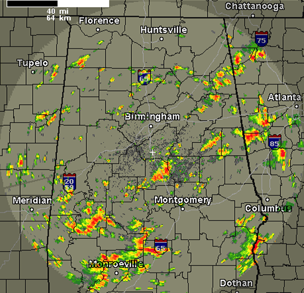
A quick look at the radar shows widespread showers and thunderstorms for many areas across Central Alabama. The very warm, moist air mass is in place is providing fuel for this activity. Daytime heating has helped increase instability, which allowed this convection to fire up during the late morning hours and now heading through the afternoon. Some of the more intense activity in our area is over portions of Chilton and Coosa Counties. There is also a complex or more intense storms over central Marengo County. Most of this activity is dropping slowly to the east-southeast today. No storms are currently severe, but some could pack a punch this afternoon. Any of these storms could produce gusty winds, frequent and dangerous lightning as well as torrential rain. Flash flooding is the main threat with these storms today.
Category: Alabama's Weather
About the Author (Author Profile)
Macon, Georgia Television Chief Meteorologist, Birmingham native, and long time Contributor on AlabamaWX. Stormchaser. I did not choose Weather, it chose Me. College Football Fanatic. @Ryan_StinnetSubscribe
If you enjoyed this article, subscribe to receive more just like it.


