

Latest Recon Info
The Air Force reconnaissance Hurricane Hunter flight fixed the center of Karen at 2:31 p.m. at latitude 25.5N, longitude 90.2 west, or a little less than 300 miles south of New Orleans.
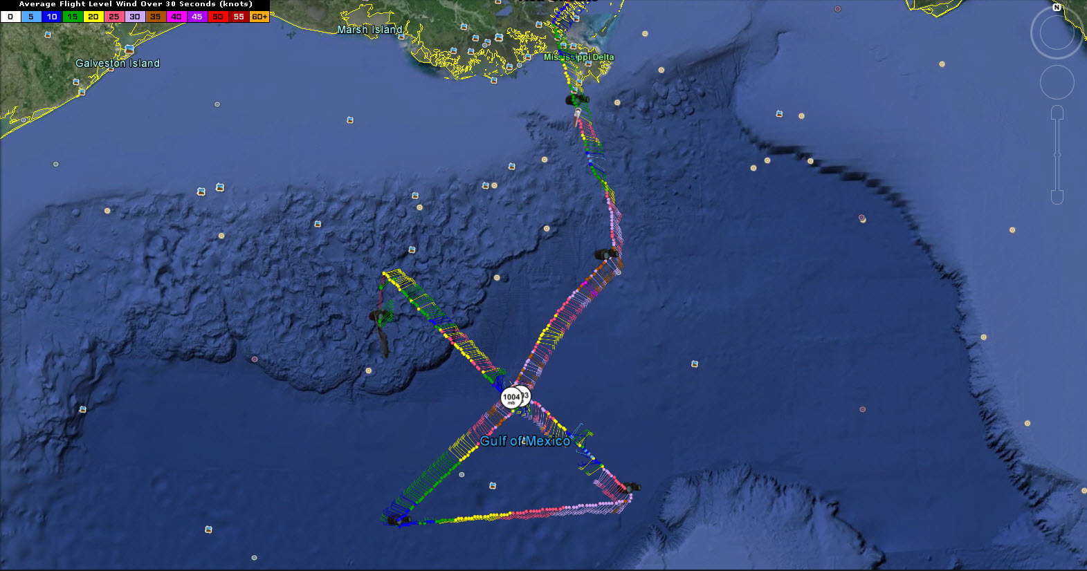
Maximum surface winds were estimated at 54 mph from the Stepped Frequency Microwave Radiometer equipment onboard the WC-130.
The minimum pressure was up another millibar to 1004 mb.
The inbound leg from the southeast found a little anomaly in the circulation, actually running into northeasterly winds where there should have been southwesterly winds. That was interesting as it could point to a secondary circulation.
So, Karen continues to fight dry air and wind shear, but it remains a tropical storm.
The new advisory and forecast package will be out shortly before 4 p.m.
Category: Alabama's Weather, Tropical
About the Author (Author Profile)
Bill Murray is the President of The Weather Factory. He is the site's official weather historian and a weekend forecaster. He also anchors the site's severe weather coverage. Bill Murray is the proud holder of National Weather Association Digital Seal #0001 @wxhistorianSubscribe
If you enjoyed this article, subscribe to receive more just like it.


