

Quick Evening Update
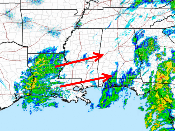
Though the more intense rain has moved out of Alabama, we are still watching an area of showers across Louisiana that is moving our direction. Latest observations with this area of showers shows mostly rain, but across eastern Texas today there have been reports of snow mixing in with the rain.
This area of showers developed with the upper-level low that is off to our west. This cold core low will be crossing Alabama tonight and will cause showers to move back into as well develop over the state. The winds are blowing out of the north bringing in cold air, and the upper-level low has a very cold pocket of air associated with it. This cold air and moisture will cause snow to develop overnight.
Timing for the snow is still expected to start just before midnight over western portions of the state and will gradually slide east through the night. The snow will fall for for several hours, but we are not expecting in travel troubles. There could be a dusting in a few areas across north-central Alabama, but the main threat for any accumulations will be east of Interstate 65.
By tomorrow morning, temps will be below freezing and with all the standing water on the local roadways, there could be a few slick spots due to black ice.
Category: Alabama's Weather
About the Author (Author Profile)
Macon, Georgia Television Chief Meteorologist, Birmingham native, and long time Contributor on AlabamaWX. Stormchaser. I did not choose Weather, it chose Me. College Football Fanatic. @Ryan_StinnetSubscribe
If you enjoyed this article, subscribe to receive more just like it.


