

Severe Weather Threat Tonight
Brian will be along later this morning with a new Weather Xtreme video; this post is to outline the severe weather risk for Alabama tonight.
The overall thinking has not changed. SPC has a “moderate risk” of severe weather up for much of North and Central Mississippi, West Tennessee, Northeast Louisiana, East Arkansas, and the northwest corner of Alabama.
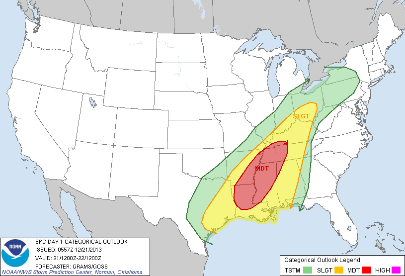
A “slight risk” extends into Alabama, west of a line from Roanoke to Florala.
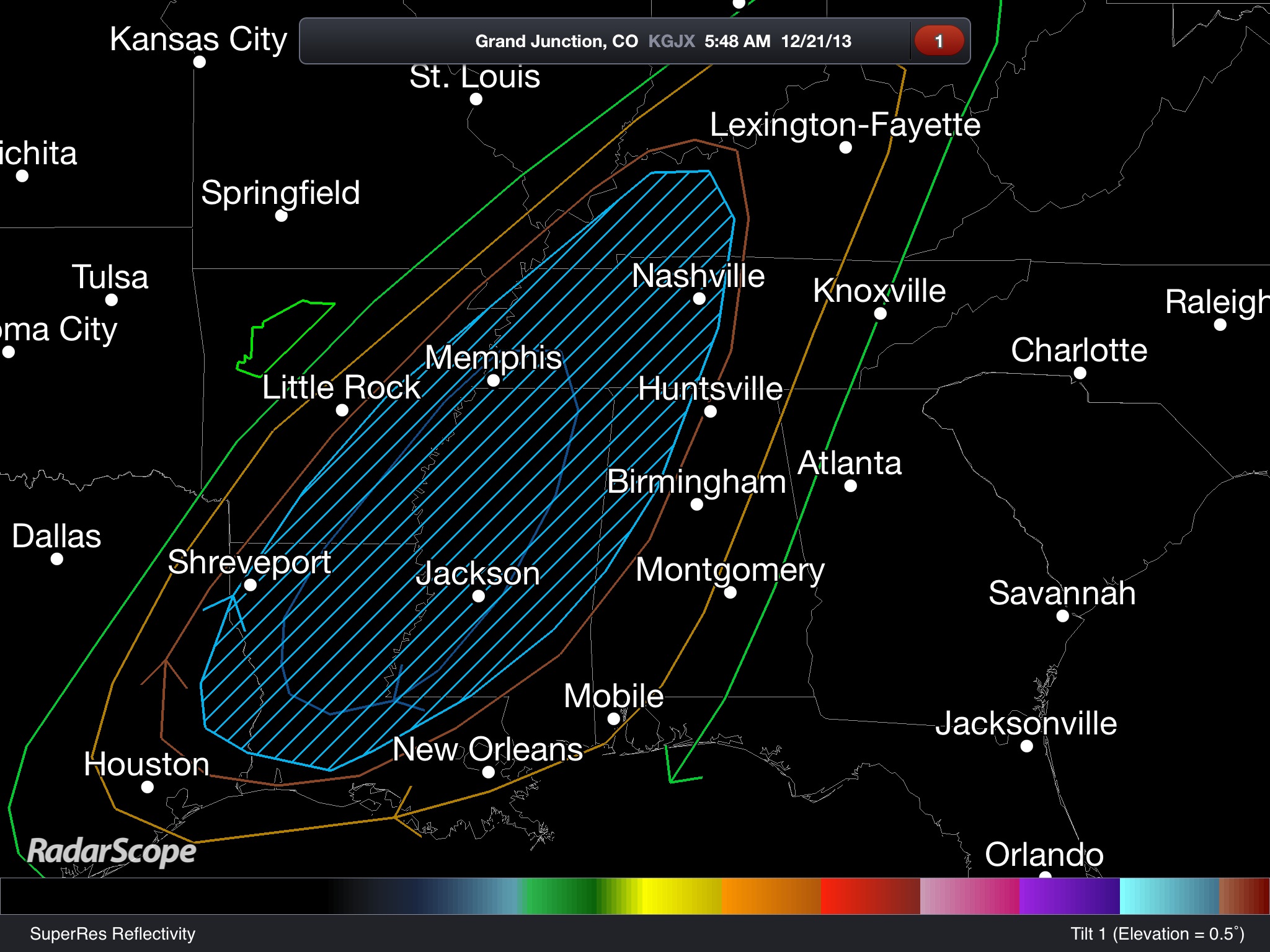
The core of the risk is defined in the cross hatched area:
THE DAYTIME HOURS: We do not expect any severe weather during the day today; it will be warm and windy with a high in the low to mid 70s, right at record levels for late December. Our record high today of 73 (set in 1923) is in danger. A few passing showers are possible, but a decent part of the day will be dry.
A wind advisory is in effect for much of Alabama today, as winds will average 12-25 mph with higher gusts.
TO THE WEST: Strong to severe storms will break out today over parts of Louisiana, Arkansas, Mississippi, and West Tennessee. If you are traveling west be aware that there is a significant severe weather risk in these states during the day; be sure you can receive severe weather warnings while you are on the road; a smart phone app like MyWarn or iMap WeatherRadio is a great idea.
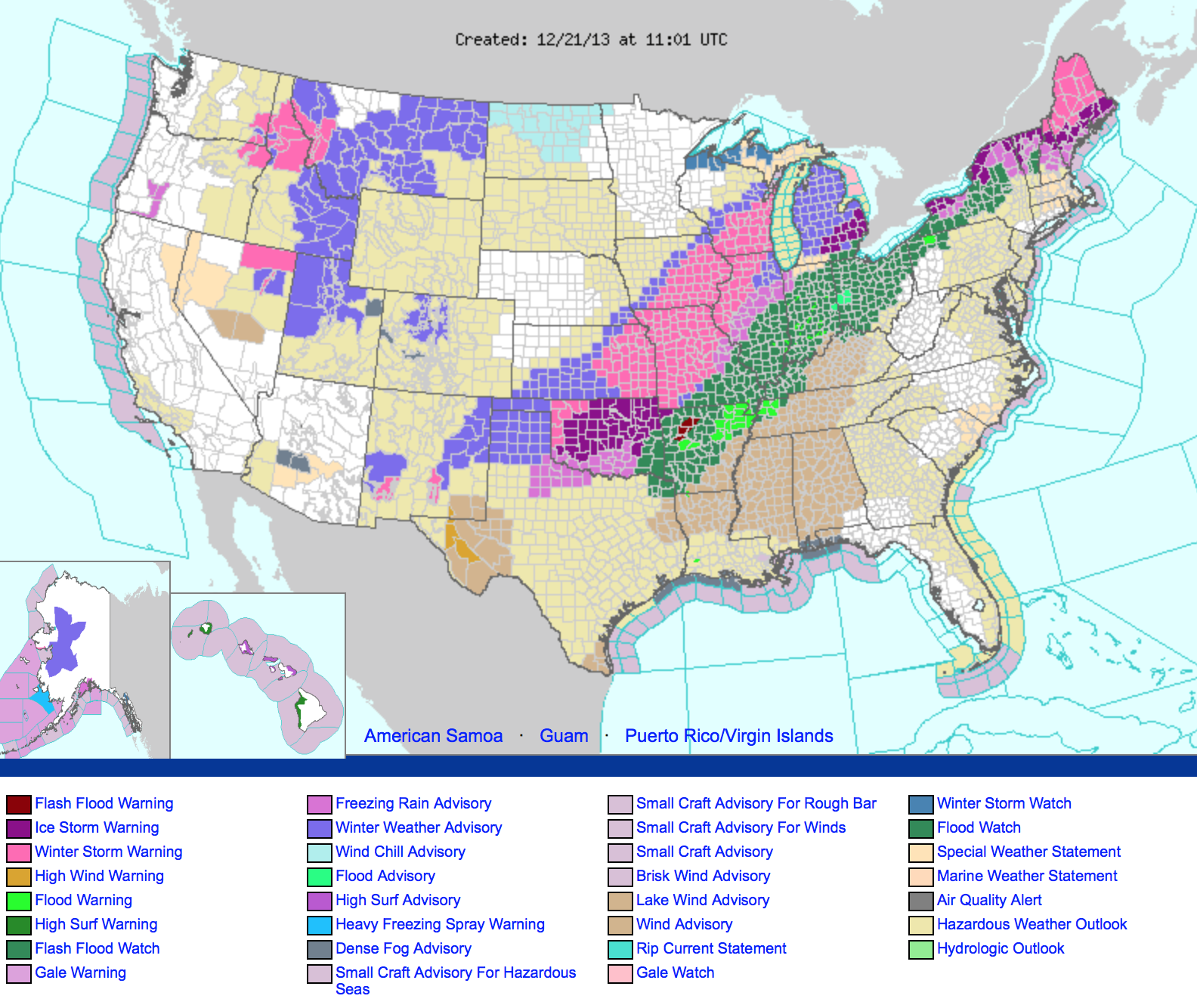
The overall weather pattern for the eastern half of the nation is very, very messy today with snow and ice issues in the cold air sector of the storm from Oklahoma to the Great Lakes.
THE ALABAMA SEVERE WEATHER THREAT: This should answer your questions about the threat in Alabama tonight.
TIMING: Storms should begin in West Alabama tonight between 8:00 and 11:00 p.m. Then, the storms will move east/southeast after midnight, and the they should exit the state tomorrow morning. The severe weather threat will end by the time most church services begin tomorrow morning over the northern half of Alabama, although storms could linger into the midday hours over South Alabama.
MODES OF SEVERE WEATHER: The primary threat will come from damaging winds within a squall line, but isolated tornadoes are possible as well. There is some potential for a few discrete storms to form ahead of the main line, and those will offer the greatest risk of a tornado. Within the line, a few short lived tornadoes are not out of the question. There is potential for tree and power line damage with the main line of thunderstorms overnight. Some hail is possible in the stronger storms.
PLACEMENT: The highest risk of isolated tornadoes is over West and Northwest Alabama between 8:00 p.m. and 1:00 a.m. Much of Alabama will have a risk of strong straight line winds, but the storms should begin to lose their punch over East Alabama early tomorrow as the better dynamics lift away to the northeast early tomorrow.
HEAVY RAIN: Rain amounts of 1 to 2 inches are likely by tomorrow morning; for now we don’t expect any major flash flooding issues, although some local problems are certainly possible.
There is no need to compare this threat to historic threats like April 27, 2011. Those are rare events and are generational. I am reading way too much hyperbole on some sites about this threat. This is not unusual… this is the core of our fall tornado season in Alabama. Severe weather threats like this are common in November and December in Alabama. Just have a way of getting warnings, and have a plan, and you will be fine.
CALL TO ACTION: Be sure you and your family have a way of hearing severe weather warnings late tonight and during the pre-dawn hours tomorrow. NEVER rely on outdoor warning sirens; they are pretty much useless in homes, businesses, schools, and churches. They reach only a small number of people outdoors.
A NOAA Weather Radio is the baseline, but you need multiple ways of receiving warnings. Good smart phone apps like MyWarn and iMap WeatherRadio work very, very well.
Don’t forget you can see all of our blog posts, and our live video streams with the James Spann 24/7 app for iOS and Android devices.
We will have frequent updates throughout the day; check with us often…
Category: Alabama's Weather
About the Author (Author Profile)
James Spann is one of the most recognized and trusted television meteorologists in the industry. He holds the AMS CCM designation and television seals from the AMS and NWA. He is a past winner of the Broadcast Meteorologist of the Year from both professional organizations.Subscribe
If you enjoyed this article, subscribe to receive more just like it.


