Clearing Coming
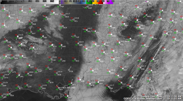
A cold and dreary Sunday is in progress across much of Central Alabama. But hang on, satellite pictures show sun is on the way. Low level moisture was working its way eastward out of the area, with much of Mississippi in sunshine by 11:30 a.m. The clearing trend had started over Northwest Alabama, where sunshine was showing up in places like Muscle Shoals, Hamilton, Fayette and Double Springs. There were even some breaks in the clouds at Demopolis.
This clearing trend should continue through the afternoon, with readings warming into the lower and middle 50s in most spots. There were a lot of clouds to the west over northeastern Texas and northern Louisiana. This cloudiness will work into Alabama later today and tonight ahead of a cold front. The clouds will keep temperatures a little warmer, in the middle 30s tonight.
The main cold front will be near Memphis by Monday morning, and will push through Alabama during the afternoon. Skies will become cloudy ahead of it and we can’t rule out an isolated shower on Monday. At least we can rule out the chance of snow flurries, as the colder air that we worried might trigger them does not look like it will be a part of the mix with this system. With the clouds, highs should be in the upper 40s tomorrow.
Category: Alabama's Weather


