

Colder Air Moves Into Alabama
**No Weather Xtreme video this morning; I am on the way back home from vacation… I will post a new video this afternoon when I am back in the weather office at ABC 33/40**
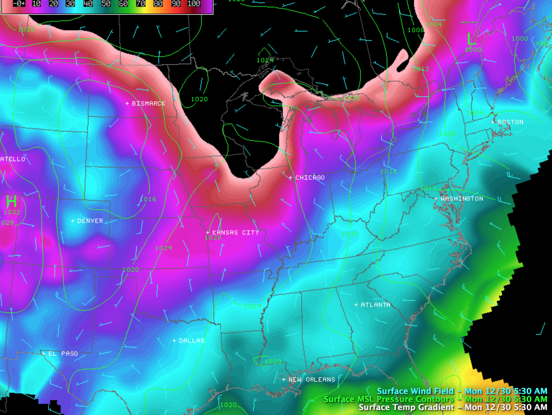
COOL CHANGE: Birmingham’s official high yesterday was 53 degrees; today will be about 5-8 degrees colder as most communities won’t make it out of the 40s this afternoon. The sky will be generally cloudy through the day, and there could be touch of light rain or a few sprinkles involved, but most places will be dry.
Be thankful the core of this cold airmass is north of Alabama; International Falls, MN reports 35 degrees below zero (F) at 5:00 a.m. CT.
Tomorrow will be cool and dry with ample sunshine and a high between 47 and 50 degrees.
MID-WEEK COLD FRONT: Clouds increase again Wednesday night ahead of the next cold front, and the GFS hints we could see some light rain by early Thursday morning.
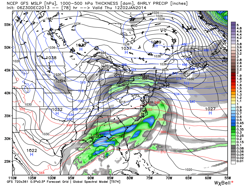
Sure looks like Thursday could be a day with falling temperatures as strong cold air advection kicks in… parts of North Alabama could settle into the 30s by midday and hold there through the afternoon. Looks like a cold, blustery day.
Friday will be dry but cold. We begin the day with a low between 16 and 21, and will see a high only around 40 degrees despite a sunny sky.
THE ALABAMA WEEKEND: Saturday will be cool and dry with a high in the low 50s. Sunday looks mostly rain-free as well, but showers will return by Sunday night and Monday with another approaching cold front.
NEXT WEEK: After a chance of showers Monday, medium range models hint at a shot of very cold air moving into Alabama by Tuesday and Wednesday, possibly the coldest air we have see so far this winter.
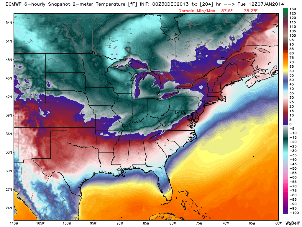
Too early to be specific about just how cold it will get here, but we will keep an eye on it in coming days.
SUGAR BOWL WEATHER: For Alabama fans headed to New Orleans for the Sugar Bowl (Thursday night; 7:30p CT kickoff), the weather will be generally cloudy in New Orleans through Thursday. Just a few widely scattered showers today and tomorrow, becoming more widespread Wednesday and Thursday. Nothing too heavy, and no severe weather. Afternoon highs will be mostly in the 50s; colder and drier air arrives Friday with the sun finally breaking through. The high Friday will drop into the 40s.
BCS NATIONAL CHAMPIONSHIP WEATHER: For now it looks like routine southern California weather for Auburn fans making the trip out west. No rain for the next 7-10 days at Pasadena, CA; highs are in the 70s, with lows between 47 and 52. Lots of sun.
WEATHER BRAINS: Don’t forget you can listen to our weekly 90 minute netcast anytime on the web, or on iTunes. This is the show all about weather featuring many familiar voices, including our meteorologists here at ABC 33/40. Greg Carbin of the Storm Prediction Center will join us tonight for our annual year ender… we look back at the top 10 weather events of 2013. The show begins at 8:30p CT; you can watch it on “James Spann 24/7” on cable systems around the state, or on the web here.
CONNECT: You can find me on all of the major social networks…
Facebook
Twitter
Google Plus
Instagram
Look for today’s Weather Xtreme video here by 4:00 this afternoon along with a fresh discussion. Enjoy the day!
Category: Alabama's Weather
About the Author (Author Profile)
James Spann is one of the most recognized and trusted television meteorologists in the industry. He holds the AMS CCM designation and television seals from the AMS and NWA. He is a past winner of the Broadcast Meteorologist of the Year from both professional organizations.Subscribe
If you enjoyed this article, subscribe to receive more just like it.


