
Afternoon Forecast Notes
No big changes in our overall thinking for the Arctic outbreak that arrives tomorrow night. National Weather Service offices in Huntsville and Birmingham have issued wind chill advisories for tomorrow night and Monday, along with a hard freeze warning.
LIGHT SNOW TOMORROW NIGHT: Some light snow is likely tomorrow night across North Alabama as the cold air rushes in with potential for a little light accumulation.
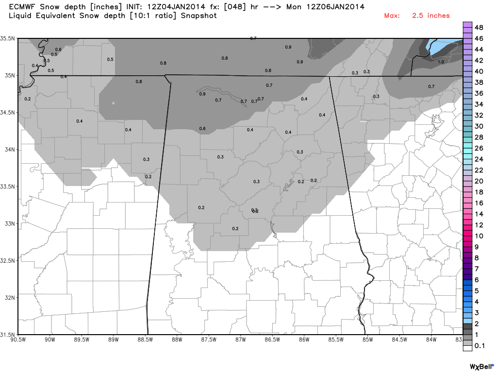
As stated here since yesterday, a dusting to 1/2 inch is possible over North Alabama, but the snow isn’t a “big deal”… some places won’t have any accumulation. The best chance of seeing one inch of so is across the higher terrain of Northeast Alabama, especially Madison, Jackson, and DeKalb Counties.
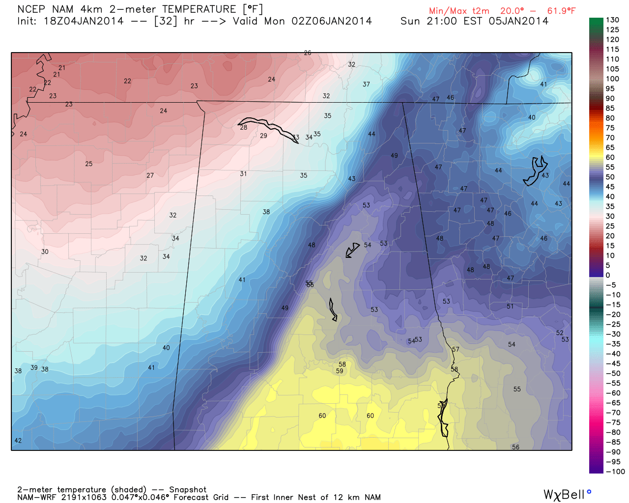
FLASH FREEZE: One concern is that temperatures will fall from the 50s into the 20s in a very short amount of time (30 minutes or so). There will be water on roads from rain showers ahead of the Arctic front, and that standing water will turn to ice very quickly, leading to some icy spots on roads. I don’t think this will be widespread, but no doubt you will need to be very careful and look for “black ice” if you are traveling anywhere tomorrow night and Monday morning. And, where snow falls, that will generate some icy places as well.
The “flash freeze” should begin in the northwest corner of the state around 6:00 p.m.. and be near I-59 (Birmingham, Tuscaloosa, Gadsden) around 8:00 p.m.
PROLONGED SUB-FREEZING PERIOD: We expect to be below freezing for over 60 hours from tomorrow night through midday Wednesday. Generally speaking, this will be the coldest airmass to impact Alabama since February 1996, almost 18 years.
MONDAY: We will drop into the 12-17 degree range early Monday, but strong north winds of 15-30 mph will generate wind chill values as cold as -10 degrees (F). We will struggle to get out of the teens Monday, and the wind chill index will remain below zero much of the day. In addition, a few snow showers or flurries are possible Monday morning in the bitterly cold air.
TUESDAY: This will be our coldest morning; we project a low between 5 and 10 degrees at daybreak Tuesday for our part of Alabama (Birmingham, Tuscaloosa, Anniston, Gadsden). The day will be sunny but cold with a high in the upper 20s. The good news is that the wind won’t be as strong.
WEDNESDAY: Wednesday morning will feature a low between 12 and 17 degrees, but we finally warm to above freezing by late morning with a sunny sky.
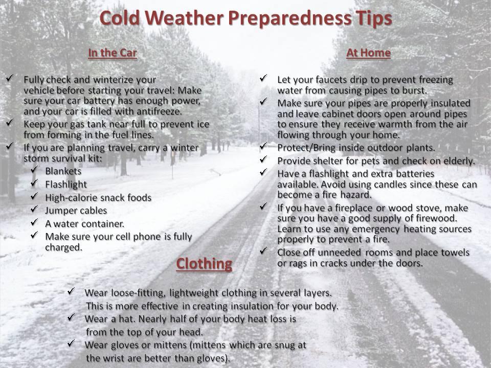
I do encourage all of you to check on elderly people that don’t have an adequate source of heat, and bring in the pets.
Stay tuned for updates through the weekend…
Category: Alabama's Weather
About the Author (Author Profile)
James Spann is one of the most recognized and trusted television meteorologists in the industry. He holds the AMS CCM designation and television seals from the AMS and NWA. He is a past winner of the Broadcast Meteorologist of the Year from both professional organizations.Subscribe
If you enjoyed this article, subscribe to receive more just like it.


