

Back In The Frigid Air Tomorrow
An all new edition of the ABC 33/40 Weather Xtreme video is available in the player on the right sidebar of the blog. You can subscribe to the Weather Xtreme video on iTunes by clicking here.
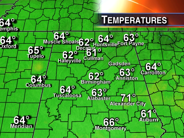
FINE JANUARY DAY: As expected, this has been a wonderful mid-winter day for Alabama, with bright sunshine and a high in the low 60s.
But, as we have warned you, don’t get used to it…
ICY AIR RETURNS TO ALABAMA TOMORROW: Arctic air will return to Alabama tomorrow complete with a strong northwest winds of 15-30 mph. The NWS has issued a wind advisory for much of North/Central Alabama, and those winds will keep wind chill index values below freezing much of the day. The actual high will be around 40 degrees.
The high resolution NAM model suggests there could be a few snow flurries tomorrow morning, mostly north of Birmingham, but the air will be very dry and they won’t amount to anything.
VERY COLD MORNINGS: We drop down into the 14-19 degree range early Wednesday morning, and we project a hard freeze for four consecutive mornings (Wednesday through Saturday). The “warmest” morning will come early Thursday with a low between 20 and 25, but we go deep into the teens by early Friday and Saturday morning.
North winds will increase again Thursday with another surge of Arctic air, and we will really have a hard time getting above freeze both Thursday and Friday; highs both days will be in the low to mid 30s.
So, while this Arctic blast won’t be quite as cold as the one we saw earlier this month, it will be longer in duration. Plan now for very cold air to cover Alabama late tonight through midday Saturday.
OUR WEEKEND: After a very cold morning with lows well down in the teens, we warm into the upper 40s Saturday afternoon, and low 50s are possible Sunday. The air will remain dry, and the sky will be mostly sunny both days.
Another surge of colder air arrives early next week, but it won’t be as cold as what we see this week.
Out in the longer range, no real sign of any major precipitation event until around February 2; see the Weather Xtreme video for the maps, graphics, and details.
WEATHER BRAINS: Don’t forget you can listen to our weekly 90 minute netcast anytime on the web, or on iTunes. This is the show all about weather featuring many familiar voices, including our meteorologists here at ABC 33/40. We will produce this week’s show at 8:30p CT tonight; watch it live on “James Spann 24/7” on cable systems around the state, or on the web here.
CONNECT: You can find me on all of the major social networks…
Facebook
Twitter
Google Plus
Instagram
Look for the next Weather Xtreme video here by 7:00 a.m. tomorrow….
Category: Alabama's Weather
About the Author (Author Profile)
James Spann is one of the most recognized and trusted television meteorologists in the industry. He holds the AMS CCM designation and television seals from the AMS and NWA. He is a past winner of the Broadcast Meteorologist of the Year from both professional organizations.Subscribe
If you enjoyed this article, subscribe to receive more just like it.


