

Cold Air Arriving Now
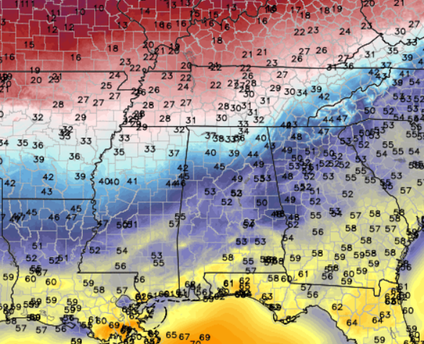
An interesting weather scenario continues to develop across Alabama and the Southeast. The first ingredient needed for some winter weather mischief is cold air. Well that cold air is arriving currently and will continue to head south throughout the afternoon. Locations across the Tennessee Valley are beginning to see temperatures drop to near the freezing mark. The front is approaching the Interstate 20 corridor currently and we will only see temps begin to take a tumble through the afternoon. Expect an increase in the winds from the north, which will advect the cold air all the way to the Gulf Coast by tonight.
Those widespread 20s to our north will likely be in place across Central Alabama by late this evening. By tomorrow morning we will be most locations in the teens for lows.
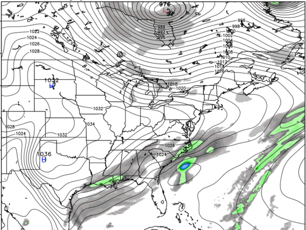
With ingredient number one, cold air, in place we will begin to look for moisture. Through out the overnight hours we will begin to see moisture levels increase as clouds and perhaps some snow flurries will be possible. By tomorrow morning, we expect to see a return flow of moisture from the south, and it will overrun the colder, more dense air near the surface. Cold air and moisture mixing together will set the stage for an interesting Tuesday and Tuesday night of weather, especially across the southern two-thirds of Alabama.
The latest run of the GFS shows moisture spreading north across the state. The snap shot below is midday tomorrow and we expect to be seeing precip falling to our south and likely as far north as the Interstate 59 corridor. With the cold air in place we expect all precip that falls across Central Alabama to be snow.
The models remain very consistent in the placement of the heaviest snowfall across the state. Areas between Mobile and Montgomery will see the heaviest snow where 2-4 inches will be possible. North of U.S. 80 and Interstate 85, 1-2 inches are possible for areas along and near Demopolis, Clanton, and Wedowee. I believe we will see snow for locations along Intestate 59, including Tuscaloosa, Birmingham, and Gadsden where a dusting is expected. The worst of the travel issues are expected to stay to our south.
As with any winter weather event in the South, there is always a surprise. We will be watching each model run and trends carefully and keep you up-to-date if anything changes.
Category: Alabama's Weather, Winter Weather
About the Author (Author Profile)
Macon, Georgia Television Chief Meteorologist, Birmingham native, and long time Contributor on AlabamaWX. Stormchaser. I did not choose Weather, it chose Me. College Football Fanatic. @Ryan_StinnetSubscribe
If you enjoyed this article, subscribe to receive more just like it.


