

Severe Weather Risk to our West
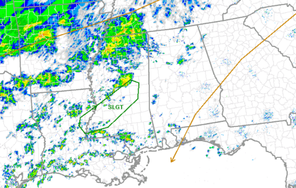
The SPC has issued their standard slight risk for severe weather just to the west of Alabama. Much of Central Mississippi has been included in the risk area outlined in green. The does include Interstates 20 & 55 as well as the city of Jackson.
Cold front moving in from the northwest and southerly flow from the Gulf of Mexico are providing the needed ingredients for the threat of severe weather today. A strong low-level jet and a boundary layer that is favorable for a few supercells are the reason for the risk being issued. The main threat with storms that form will be damaging winds and tornadoes.
At this time, no part of Alabama is included in a risk. We will continue to see showers develop and move north across the state in the warm sector. Later this evening, we are expecting to see a few thunderstorms, and we will have to watch and see if the SPC extends the risk eastward in later convective outlooks.
Category: Alabama's Weather
About the Author (Author Profile)
Macon, Georgia Television Chief Meteorologist, Birmingham native, and long time Contributor on AlabamaWX. Stormchaser. I did not choose Weather, it chose Me. College Football Fanatic. @Ryan_StinnetSubscribe
If you enjoyed this article, subscribe to receive more just like it.


