Good Soaking Tonight; Drier Tomorrow
An all new edition of the ABC 33/40 Weather Xtreme video is available in the player on the right sidebar of the blog. You can subscribe to the Weather Xtreme video on iTunes by clicking here.
RADAR CHECK: Scattered showers are over North Alabama this afternoon, associated with a northward moving warm front. Heavier showers at 3:00 p.m. were between Anniston and Gadsden. Temperatures are generally in the 50s with low clouds and fog in many places.
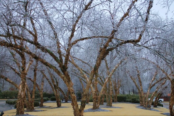
NORTHWEST OF ALABAMA: A nasty ice storm over parts of Arkansas today, including Little Rock (photo from @cumulusmaximus)
Big snows are in progress from Kansas through Missouri, and winter storm warnings are up all the way from Kansas City to Boston.
GOOD SOAKING TONIGHT: Rain becomes widespread across Alabama tonight as the upper trough approaches. Rain amounts of 1/2 to 1 inch are likely, and while we could hear some thunder, no severe weather is expected. SPC has even dropped the low end 5 percent severe weather possibility for far Southwest Alabama. Most of the rain will come from 6:00 p.m. through 3:00 a.m.
TOMORROW THROUGH FRIDAY: Tomorrow will be mostly cloudy, breezy, and colder. The high will be in the 40s as air will be flowing over the snow pack north of Alabama and into our state. Look for a low down in the mid 20s by daybreak Thursday.
Thursday and Friday look dry with some filtered sunshine possible both days through the clouds. Thursday will be cold with a high only in the 41-45 degree range, but we warm into the low 50s Friday.
THE ALABAMA WEEKEND: The 12Z models continue to show a weaker mid latitude wave at a higher latitude, meaning mostly light rain for Alabama. But, I caution you this could change again as we get closer to the weekend. But, based on the last few runs of the global models we will mention the risk of some light rain Saturday and Saturday night, then expect a blustery day Sunday with temperatures falling into the 30s with lingering clouds. A few snow flurries are possible Sunday over North Alabama, mainly north of Birmingham, but they won’t amount to much if the morning runs verify.
The high Saturday will be in the 50s before the cold air returns Sunday.
NEXT WEEK: The low early Monday will be in the low 20s; highs Monday and Tuesday should be in the mid to upper 40s. The next rain event comes at mid-week on Wednesday or Thursday. Take some time to watch the Weather Xtreme video for the maps, graphics, and details.
STORM ALERT 2014: Our annual severe weather awareness tour across Alabama kicks off this Thursday; we will be at Gadsden City High School at 6:30 (doors open at 5:00). You will get an introduction to storm spotting, see the “good, the bad, and the ugly” concerning last week’s snow, learn how to stay safe this tornado season, and have a chance to win some cool stuff. If you have kids that love weather, bring them. They will love it. Hope to see you Thursday evening in Gadsden.
WEATHER BRAINS: Don’t forget you can listen to our weekly 90 minute netcast anytime on the web, or on iTunes. This is the show all about weather featuring many familiar voices, including our meteorologists here at ABC 33/40.
CONNECT: You can find me on all of the major social networks…
Facebook
Twitter
Google Plus
Instagram
I had a great time today at the Livingston Community Center seeing the kids from Sumter County Head Start… be watching for them on the Pepsi KIDCAM today at 5:00 on ABC 33/40 News! The next Weather Xtreme video will be posted here by 7:00 a.m. tomorrow…
Category: Alabama's Weather


