

Important Points For Tonight/Tomorrow
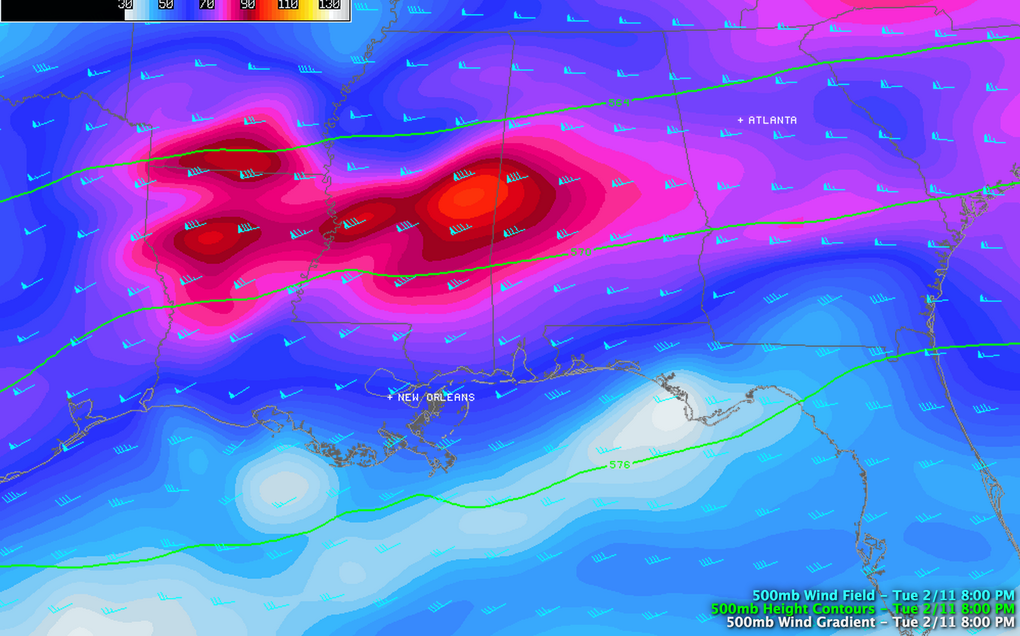
*The storm system that is moving into Alabama is very dynamic. Good upper support, high moisture, and cold air damming that will bring in the cold air from the east. Radar is lighting up like a Christmas tree west of our state tonight over Mississippi, southern Arkansas, Louisiana, and East Texas.
Note the wind max at 500 mb moving into Alabama from the west…
*Rain will become widespread across Alabama during the next few hours. Some sleet has been reported over the western side of the state, but it is mostly liquid. Temperature are generally in the mid to upper 30s along the I-20 corridor, and we expect just a cold rain tonight for cities like Tuscaloosa, Birmingham, and Anniston.
*To the north, it is colder. There could be some freezing rain/sleet/snow issues after midnight generally north of U.S. 278 (Hamilton to Cullman to Gadsden), with potential for hazardous driving.
*The big problem comes tomorrow as a strong surface low spins up just below Mobile, and cold air is pulled into Alabama from the east. We project freezing rain/sleet/snow over Northeast Alabama early tomorrow morning, with rain elsewhere. The line between a cold rain and snow and ice will move southwest during the morning, and by midday freezing rain or snow should be relatively widespread over East Alabama.
The change to freezing rain and snow should begin in Birmingham sometime between 12:00 and 4:00 p.m.
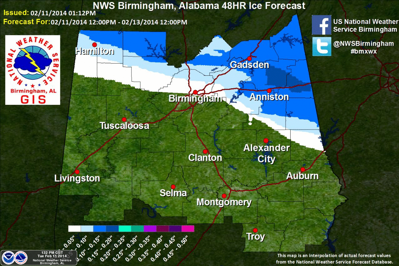
*There is great concern that a long period of freezing rain over East Alabama tomorrow (rain in liquid form that falls with surface temperatures below 32 degrees) will result in significant ice accumulation. Maybe even enough ice for power outages. Some of the counties that will see the highest risk of significant ice are Cleburne, Calhoun, Randolph, Clay, and Chambers. Even some chance of significant ice into Lee and Tallapoosa Counties as well.
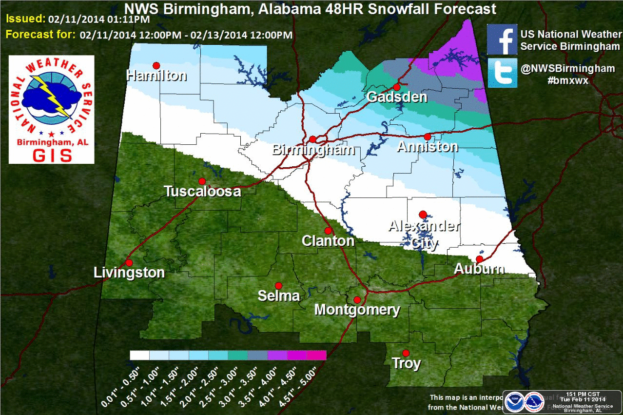
*As the low pulls to the northeast and strengthens, dynamic cooling will become more pronounced, and a deformation axis might set up, meaning enhanced upward motion and potential for a band of very heavy snow. Where this happens nobody really knows, but there is clearly a shot of some big snow amounts somewhere over Northeast Alabama tomorrow afternoon and into the evening hours.
*The southern edge of the snow and ice will be roughly along a line from Hamilton to Birmingham to Sylacauga to Lafayette. It will be mostly a cold rain south and west of this line. It correlates with the winter storm warning.
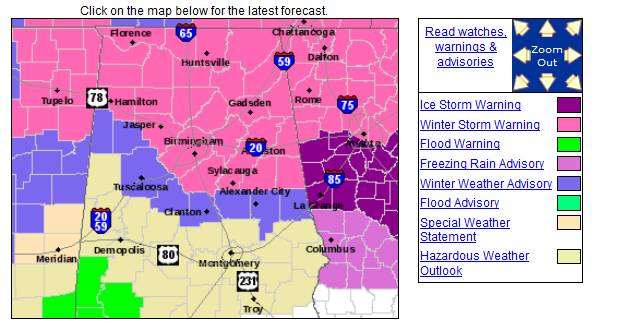
*There is high potential for a crippling ice storm east of Alabama tomorrow and tomorrow night through much of North and Central Georgia, and South Carolina. Some people could be without power for over a week in these areas. Far East-Central Alabama could have major ices issues as well, as discussed above.
*I have seen a little of the 00Z model runs, and I honestly don’t trust them. Better to just look for radar and satellite trends. Clearly this system has the potential to “overperform” tonight and tomorrow, and the snow/ice forecasts below from the NWS might have to be ramped up some in places. Stay tuned to the blog overnight and tomorrow for updates…
*There could be enough snow and ice for travel issues to continue into Thursday morning across parts of Alabama as temperatures go below freezing.
*On a positive note, a warming trend begins Thursday afternoon, and we reach the low 60s by Sunday!
Category: Alabama's Weather
About the Author (Author Profile)
James Spann is one of the most recognized and trusted television meteorologists in the industry. He holds the AMS CCM designation and television seals from the AMS and NWA. He is a past winner of the Broadcast Meteorologist of the Year from both professional organizations.Subscribe
If you enjoyed this article, subscribe to receive more just like it.


