

A Little Thunder in Eastern Mississippi
All afternoon, we have been wondering if there would be any thunder with the activity coming out of Mississippi into Alabama tonight.
We have gotten our answer in the past few minutes as lightning has developed from north of Yazoo City up to Aberdeen.
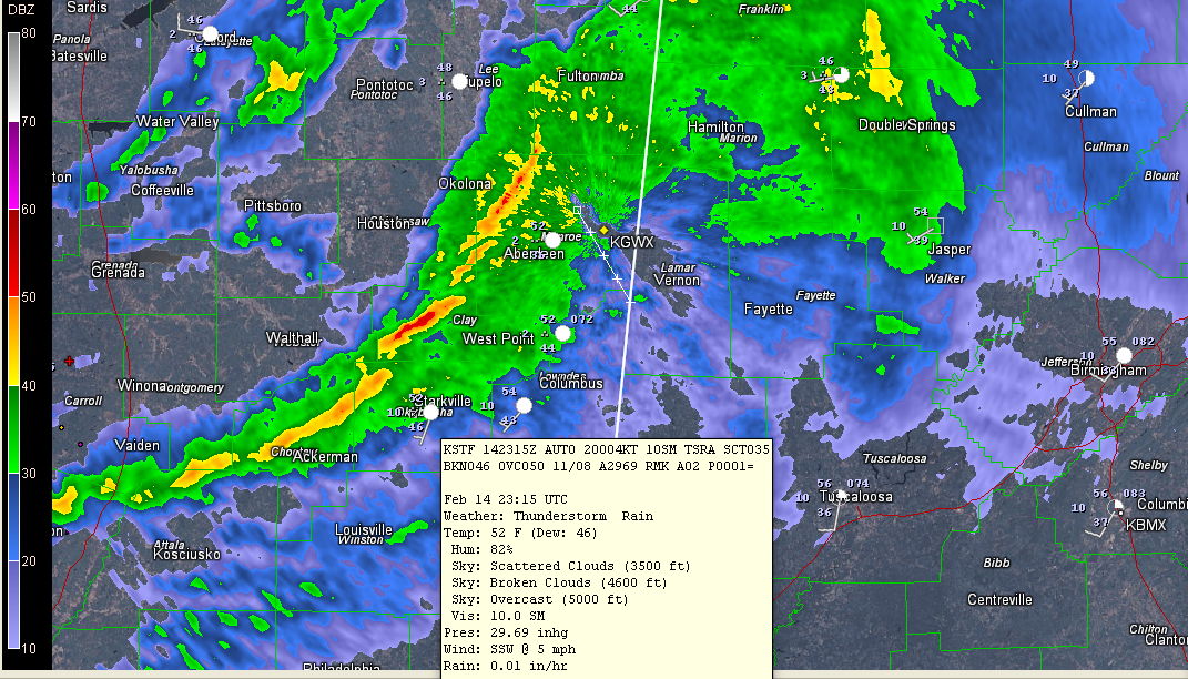
Click image to enlarge.
A thunderstorm was being reported at Starkville on the last observation. The lightning count appears to be increasing and reflectivities on the radar are edging up as well, especially between Ackerman and Starkville. The storms around Columbus are entering Lamar County near Sulligent.
I would say that it is hard to imagine, with temperatures in the 50F degree range with dewpoints in the mid 40s, but we already saw lightning occur this week in the snow. All it takes is a little instability.
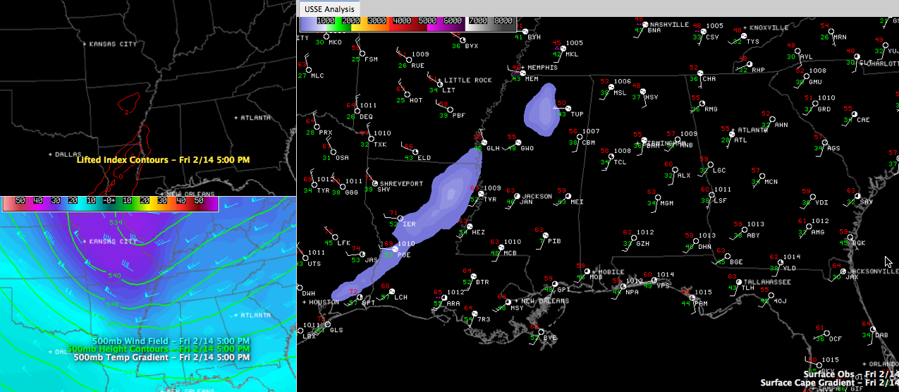
You can see a little instability (CAPE values250-500 j/kg) over parts of northern Mississippi and Louisiana. The instability is courtesy of some very cold temperatures aloft associated with an approaching upper level trough. Temperatures at about 10,000 feet are 7C, while at 18,000 feet they are -23C. This results in lapse rates approaching -6.5 degrees. That is slightly unstable.
While you won’t see any severe weather from these storms, there will be a little thunder over western Alabama it appears this evening.
Category: Alabama's Weather
About the Author (Author Profile)
Bill Murray is the President of The Weather Factory. He is the site's official weather historian and a weekend forecaster. He also anchors the site's severe weather coverage. Bill Murray is the proud holder of National Weather Association Digital Seal #0001 @wxhistorianSubscribe
If you enjoyed this article, subscribe to receive more just like it.


