

Weekend Warm-Up Ahead
An all new edition of the ABC 33/40 Weather Xtreme video is available in the player on the right sidebar of the blog. You can subscribe to the Weather Xtreme video on iTunes by clicking here.
SOME RAIN TONIGHT: All is quiet across Alabama this afternoon with sunshine through high clouds, and temperatures mostly in the mid to upper 50s. Clouds will thicken this evening, and we will continue to mention a chance of showers tonight as a short wave west of the state moves through. Steep lapse rates mean some spots might even hear a little thunder, as a few elevated thunderstorms could form. The best chance of showers will come from about 6:00 this evening through 3:00 a.m. tomorrow. Rain amounts should be under 1/4 inch in most spots.
WARMER WEEKEND: The weekend looks rain-free with a mix of sun and clouds both days and a big warming trend. Expect a high in the mid to upper 60s tomorrow, and both the NAM and the GFS are printing a high of 75 degrees for Birmingham on Sunday. That won’t be a record, however… our record high for March 2 is 83 degrees set in 1976.
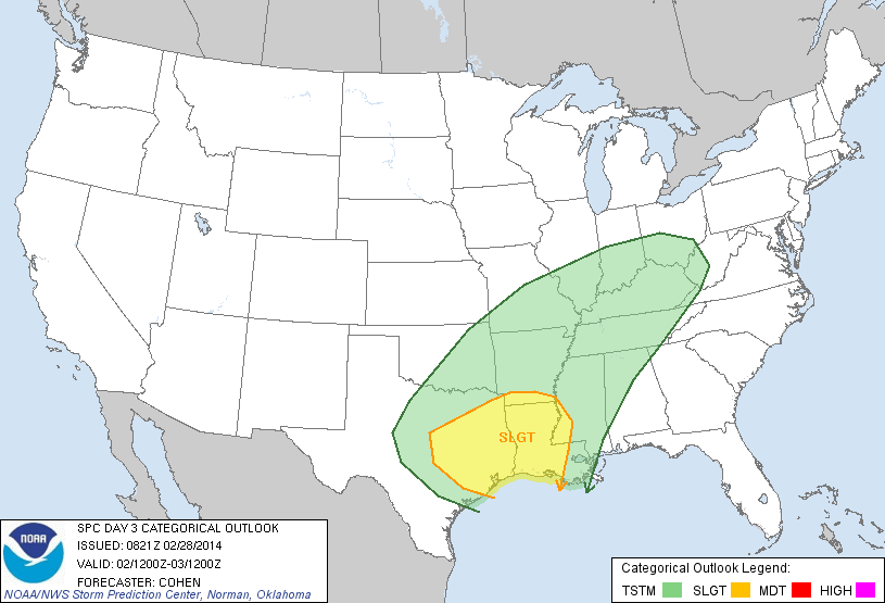
SUNDAY NIGHT/MONDAY: A big mass of rain and thunderstorms will develop west of Alabama during the day Sunday; in fact SPC has parts of East Texas, much of Louisiana, and some of the adjacent states under the standard “slight risk” of severe storms Sunday.
It is also interesting to note that in the cold air sector of this storm, snow and ice is expected to be a big problem all the way from East Oklahoma, Northern Arkansas, and East Kansas all the way to Pennsylvania Sunday into Monday.
Here in Alabama, we will just deal with rain. The best chance of rain will come from about midnight Sunday night through noon Monday. The air will be stable, and while some thunder is possible, severe weather is not expected. Rain amounts of around 1/2 inch are likely.
Monday will be sharply colder; I am beginning to get the idea we might hold in the chilly 40s all day over North and Central Alabama as colder air spills returns.
REST OF NEXT WEEK: Tuesday morning will be cold with a low well down in the 20s, but we warm into the low 50s Tuesday afternoon. Then, rather vigorous cyclogenesis is expected in the northern Gulf of Mexico Wednesday. This will spread rain back into Alabama, with the best chance of wet weather coming Wednesday afternoon, Wednesday night, and Thursday morning. If we would have Arctic air in place, this would be a great snow setup for North Alabama, but thickness values look way too warm, and we are just forecasting rain for now.
Drier air will return late in the week on Friday. See the Weather Xtreme video for the maps, graphics, and details.
WEATHER BRAINS: Don’t forget you can listen to our weekly 90 minute netcast anytime on the web, or on iTunes. This is the show all about weather featuring many familiar voices, including our meteorologists here at ABC 33/40.
CONNECT: You can find me on all of the major social networks…
Facebook
Twitter
Google Plus
Instagram
I enjoyed seeing the kids at Vincent Elementary today… I had the honor of reading “Cat In The Hat” for Read Across America Day. Look for my next Weather Xtreme video here Monday morning by 7:00… Brian Peters will have the video updates here tomorrow and Sunday. Enjoy the weekend!
Category: Alabama's Weather
About the Author (Author Profile)
James Spann is one of the most recognized and trusted television meteorologists in the industry. He holds the AMS CCM designation and television seals from the AMS and NWA. He is a past winner of the Broadcast Meteorologist of the Year from both professional organizations.Subscribe
If you enjoyed this article, subscribe to receive more just like it.


