

Punching the Core
As we are traveling south from Nashville to Birmingham this afternoon, the vehicle’s thermometer has been clicking upward almost as fast as the odometer! We left Nashville at 37F but by US-64 near Pulaski, it was 49F. We are punching the core of the cold front! Within 8 miles, the temperature jumped 8 degrees! Within 10 miles, it had gone up 11F.
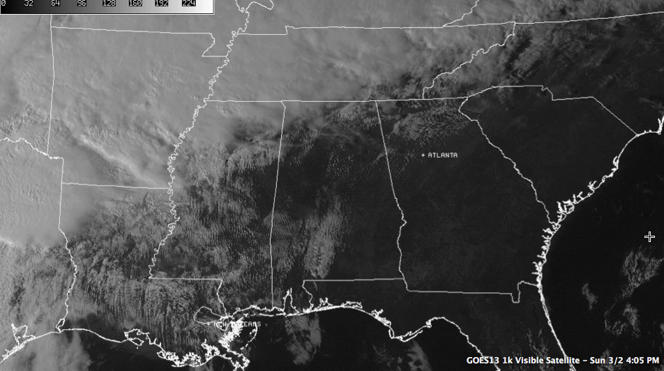
You can see the sunny conditions across much of Central Alabama on the visible satellite picture:
OPERATION WINTER WEATHER WATCH: Once again we are on Operation Winter Weather Watch here in the AlabamaWX Weather Center, seemingly for the umpteenth time this season. The good news is that significant problems are not expected in our state, but icing is possible across the northwestern parts of North Central Alabama, as well as Northwest and North Alabama late tonight and early Monday morning. We will be tracking the latest weather developments until the precipitation ends Monday morning.
DIFFERENT STORY: It is a different story to our north and northwest where winter weather advisories and winter storm warnings cover a wide area from the southern Plains through the Ohio and Tennessee River Valleys into the Mid Atlantic states and the Northeast U.S. through Monday. Throw in some wind chill warnings for places like Minnesota and you have a real mess.
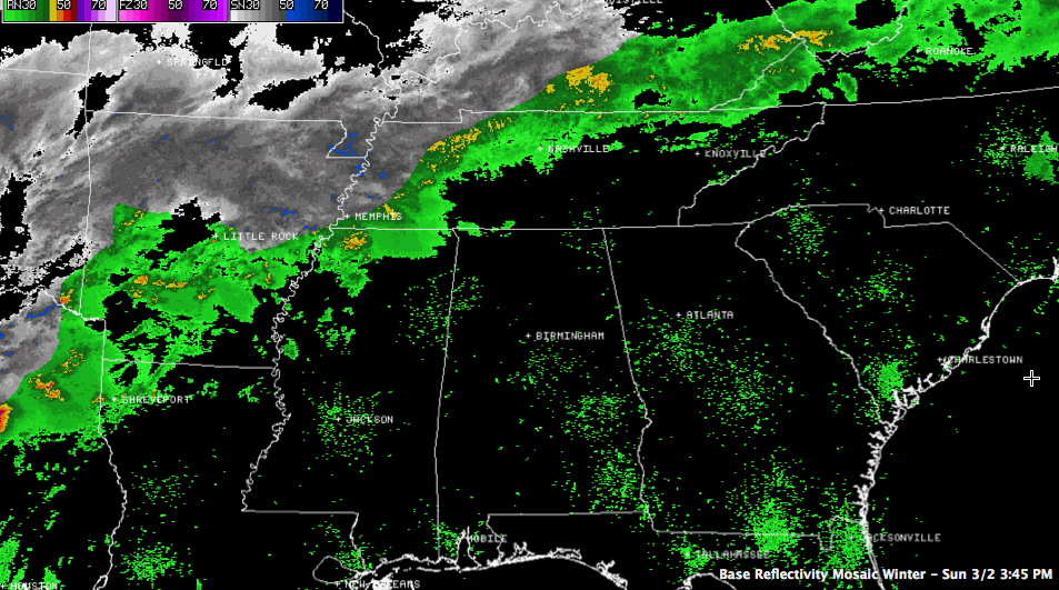
Regional radars show the precipitation associated with the system with the wintry mix in white:
ALABAMA ADVISORIES: The NWS Birmingham has a freezing rain advisory posted for Marion, Winston, Walker, Fayette and Lamar Counties, generally north of a line from Vernon to Hubbertville to Manchester in Walker County. The NWS Huntsville has a winter weather advisory up for late tonight and Monday morning for Colbert, Lauderdale, Franklin, Lawrence and Limestone Counties. As the shallow cold air pushes into Alabama tonight, precipitation behind the front will freeze on contact with exposed surfaces in the advisory areas. There will be some sleet mixed in as well, especially the further northwest you go.
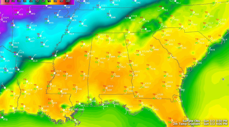
HARD TO IMAGINE: It’s hard to imagine that we could be talking about wintry weather after the Sunday afternoon we enjoyed across Central Alabama. Morning clouds northwest of I-59 burned off and the entire area enjoyed a good supply of sunshine pushing temperatures into the middle and upper 70s. At 3 p.m. along I-65 this afternoon, it was 78F in Montgomery, 74F in Birmingham, 72F at Huntsville, 39F at Columbia TN and 37F at the Nashville Airport, where snow had started.
Category: Alabama's Weather, Winter Weather
About the Author (Author Profile)
Bill Murray is the President of The Weather Factory. He is the site's official weather historian and a weekend forecaster. He also anchors the site's severe weather coverage. Bill Murray is the proud holder of National Weather Association Digital Seal #0001 @wxhistorianSubscribe
If you enjoyed this article, subscribe to receive more just like it.


