

And Storms Too…
I don’t have to remind you that our dynamic storm system has a warm sector, given the highs in the 70s across Alabama. It was 76F in Birmingham, 77F in Tuscaloosa and 79F in Montgomery.
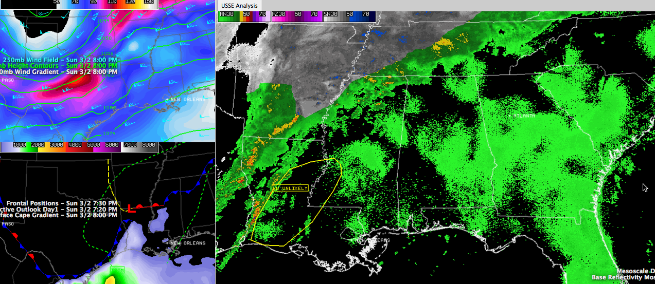
Click image to enlarge.
The surface low tonight is over southern Arkansas as you can see in the bottom left panel of the graphic.
A line of thunderstorms has developed over western Louisiana and southern Arkansas. The SPC has mentioned a 20% chance that they might have to issue a severe thunderstorm watch ahead of it. (See the large panel on the graphic.) Instability values are low, but there wind fields are strong, so there may be a few damaging winds tonight.
You can see the upper trough over the Texas Panhandle and Oklahoma in the top left penl, with shows jet stream level winds. In that same panel, you can see the associated wind maximum that is helping to unfortunately increase lift over the precipitation area behind the cold front.
Lightning is common all the way into western Tennessee. Once again, we have thundersleet and freezing rain with thunder.
We will be watching the model data that is satrting to come in and will be updating our forecast. We will have additional information here on the blog shortly for North and Central Alabama.
Category: Alabama's Weather, Headlines, Severe Weather
About the Author (Author Profile)
Bill Murray is the President of The Weather Factory. He is the site's official weather historian and a weekend forecaster. He also anchors the site's severe weather coverage. Bill Murray is the proud holder of National Weather Association Digital Seal #0001 @wxhistorianSubscribe
If you enjoyed this article, subscribe to receive more just like it.


