

Windy/Falling Temps Later Today
An all new edition of the ABC 33/40 Weather Xtreme video is available in the player on the right sidebar of the blog. You can subscribe to the Weather Xtreme video on iTunes by clicking here.
ON THE MAPS: A strong cold front this morning was moving into the northern part of Tennessee; it will move steadily southward into Alabama later this morning. Ahead of the front, temperatures are relatively mild, with mostly low 60s at daybreak.
We expect a band of showers along the front late this morning; rain amounts will be under 1/4 inch. High resolution model data suggests the front will pass through Birmingham and the I-59 corridor around 12:00 noon.
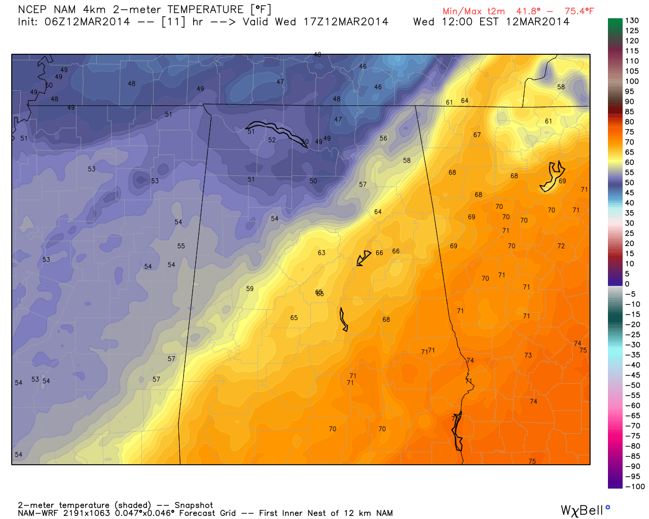
WINDY AND COLDER: In the wake of the cold front, the afternoon will feature strong north winds averaging 15-30 mph. A wind advisory is in effect for all of Alabama except for the southeast corner of the state. And, temperatures will fall from the 60s late this morning, into the upper 40s by late afternoon.
FREEZE TONIGHT: The sky becomes clear tonight, and the wind will die down, allowing for temperatures to fall quickly. We project lows by daybreak tomorrow in the 26-32 degree range for most communities. Friday morning will be cold as well with potential for another light freeze in a few pockets; the low early Friday will be in the low to mid 30s.
Expect a sunny sky tomorrow and Friday. Tomorrow will be cool with a high in the low 50s, but we rise into the 60s Friday afternoon.
SHOWERY WEEKEND: Moist air returns to the state Friday night, and we will dodge raindrops at times over the weekend. It is impossible to tell you at this point exactly when the rain will start and stop, but a few showers or patches of light rain are possible as early as the pre-dawn hours Saturday morning. The latest GFS hints the rain will be a little more widespread by Saturday afternoon into Saturday night.
We will hang on to the risk of lingering showers on Sunday as the moisture pool stays in place, and a cold front approaches from the north.
Some points about the weekend rain chances…
*It will not rain all weekend long
*The rain could come at any time over the weekend, however
*A little thunder is possible, but it will mostly rain showers
*No severe weather
*Rain amounts of 1/2 to 3/4 inch are likely
Highs over the weekend will be in the 60s.
NEXT WEEK: Drier air returns to the state Monday, and at this point next week looks generally dry with seasonal temperatures; highs in the 60s, lows in the 40s.
There is evidence the last 7-10 days of the month could be relatively wet, but at this point we still see no signs of any major severe weather issues. See the Weather Xtreme video for the maps, graphics, and more details.
WEATHER BRAINS: Don’t forget you can listen to our weekly 90 minute netcast anytime on the web, or on iTunes. This is the show all about weather featuring many familiar voices, including our meteorologists here at ABC 33/40.
CONNECT: You can find me on all of the major social networks…
Facebook
Twitter
Google Plus
Instagram
I have a weather program this morning at Coldwater Elementary School in Calhoun County… look for the next Weather Xtreme video here by 4:00 or so this afternoon. Enjoy the day…
Category: Alabama's Weather
About the Author (Author Profile)
James Spann is one of the most recognized and trusted television meteorologists in the industry. He holds the AMS CCM designation and television seals from the AMS and NWA. He is a past winner of the Broadcast Meteorologist of the Year from both professional organizations.Subscribe
If you enjoyed this article, subscribe to receive more just like it.


