

Storm Over Blount County
LATE REPORT
1/2 inch sized hail reported in Nectar at 6:35.
Just before 7 p.m., the core was passing south of Rosa and turning a little right towards Oneonta. It has weakened some.
As expected with the colder air aloft associated with the approaching upper trough and the wee bit of sunshine we have had today, isolated showers have developed over North Central Alabama.
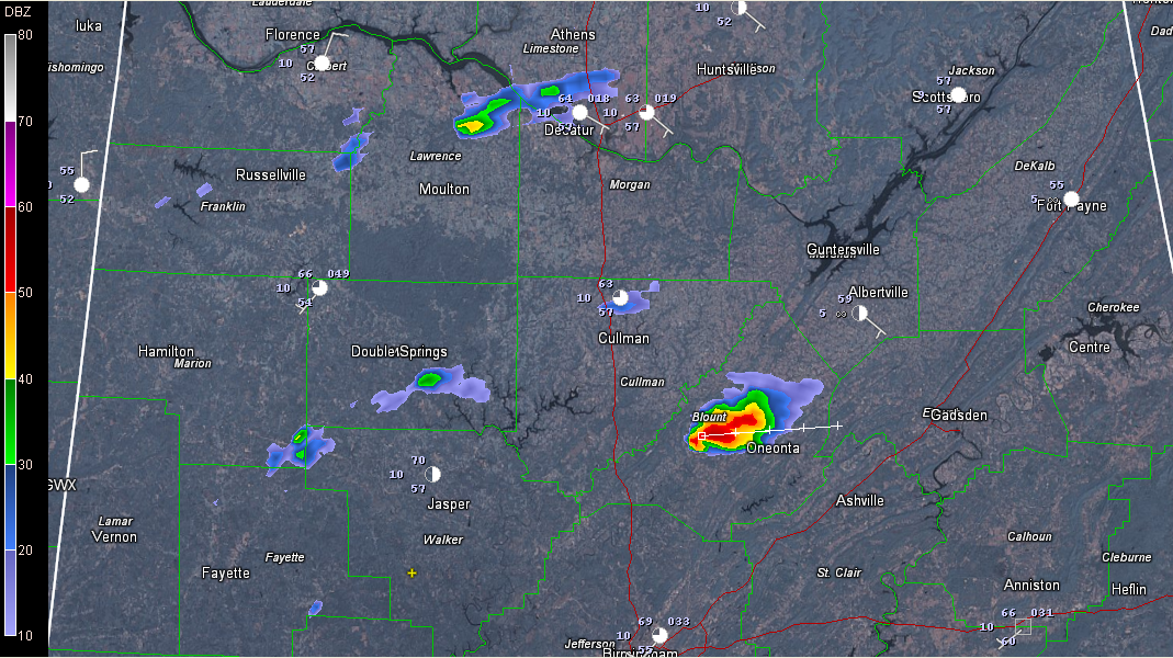
One over Blount County is now a thunderstorm, with tops approaching 30,000 feet and lightning. It is located between Oneonta and Blountsville.
It is moving east at 20 mph. It will pass near Altoona and Steele as well as just north of Oneonta.
It is beginning to show signs of small hail.
On radar it has decent organization, thanks to 40-45 knots of bulk wind shear, taking on a bit of a kidney bean shape.
There is a small amount of helicity (around 50 m2/s2 in the 0-1km layer), so we can’t rule out a small tornado. Due to its organization, there is a chance of it becoming severe from a damaging wind or hail standpoint is small as well, so we will keep an eye on it.
Category: Alabama's Weather, Severe Weather
About the Author (Author Profile)
Bill Murray is the President of The Weather Factory. He is the site's official weather historian and a weekend forecaster. He also anchors the site's severe weather coverage. Bill Murray is the proud holder of National Weather Association Digital Seal #0001 @wxhistorianSubscribe
If you enjoyed this article, subscribe to receive more just like it.


