

A Few Showers and Storms
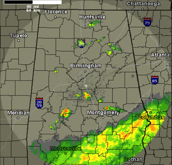
We are still watching a few showers and storms moving across north-central Alabama this evening. This convection developed in response to the warmer temps today brought on by the breaks in the clouds we had this afternoon, and an upper-level trough moving across the area, which has allowed for a bit of instability to build across the region.
The activity will remain widely scattered the rest of this evening and most locations across Central Alabama will remain dry. If you get caught under one of these storms, you could possibly have heavy rain, gusty winds, some hail, and lightning. The storms will not last long and will continue to drift towards the east the next few hours out ahead of the front. Some of the stronger activity currently is affecting portions of Chilton, Perry, and Elmore counties.
There were a few reports of hail via social media earlier with a storm that moved across Blount County.
Across southern portions of the state, there continues to be moderate to heavy rain falling along the Gulf Coast and into some of our southeastern counties. The bulk of this activity is south of Interstate 85 and is affecting areas around Troy and Eufaula.
Category: Alabama's Weather
About the Author (Author Profile)
Macon, Georgia Television Chief Meteorologist, Birmingham native, and long time Contributor on AlabamaWX. Stormchaser. I did not choose Weather, it chose Me. College Football Fanatic. @Ryan_StinnetSubscribe
If you enjoyed this article, subscribe to receive more just like it.


