

Update Just Before Noon
Saturday is turning out to be a pretty nice day across Central Alabama. The satellite view shows some altocumulus clouds around 10 to 12 thousand feet over the Tennessee River Valley with a blanket of thin cirrus clouds between 20,000 and 35,000 feet over much of the rest of the state. Radar showed a few showers across the northwestern counties of Alabama, but any rainfall there was light.
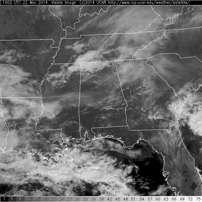
Those cirrus clouds were filtering the sun a bit, however, temperatures had climbed to near the 70-degree mark just before noon. Temperatures across the Tennessee River Valley with the mid deck of clouds were about 7 to 10 degrees cooler as those clouds blocked a bit more of the warming sunshine.
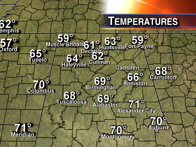
Looks like the the forecast for today is on track as temperatures should warm into the lower and middle 70s across Central Alabama. The cold front to the north of us will slowly inch our way, so tomorrow should be a mostly cloudy day with showers and patchy areas of rain off and on along with noticeably cooler temperatures. Western Kentucky was in the 40s near noon, and that chillier air should settle into Central Alabama with highs Sunday only in the upper 50s and lower 60s.
There was a 103 degree difference in the highest and lowest temperatures across the continental US between yesterday afternoon and this morning. The high temperature for Friday was 92 at Dryden, TX, while the low temperature this morning was -11 at Waskish, MN.
-Brian-
Category: Alabama's Weather
About the Author (Author Profile)
Brian Peters is one of the television meteorologists at ABC3340 in Birmingham and a retired NWS Warning Coordination Meteorologist. He handles the weekend Weather Xtreme Videos and forecast discussion and is the Webmaster for the popular WeatherBrains podcast.Subscribe
If you enjoyed this article, subscribe to receive more just like it.


