

Strong Storms Tomorrow Night
Brian will be along shortly with the full discussion and a new Weather Xtreme video… this is just a quick look at the severe weather/heavy rain potential for Alabama late tomorrow night into Monday morning. You won’t have any weather issues today; we expect ample sunshine with a high in the 60s.
SPC maintains the “slight risk” of severe weather for mostly South Alabama in their “Day Three” convective outlook, which runs from 7 a.m. tomorrow through 7 a.m. Monday.
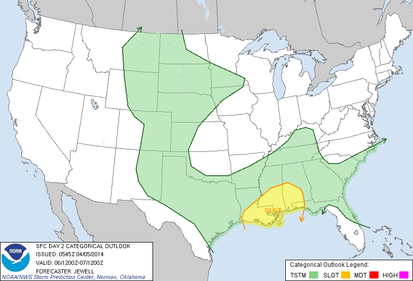
A very dynamic weather system will develop with strong wind fields, upward motion, and wind shear. The biggest questions involves instability; this will be the limiting factor, and is the reason SPC has only the southern part of Alabama outlooked for now. Seems like the highest risk of severe weather will come from about 10:00 tomorrow night through 10:00 Monday morning, mainly south of a line from Tuscaloosa to Montgomery to Troy to Geneva.
Storms in this part of Alabama will be capable of producing strong, possibly damaging winds and a few tornadoes. And, with the risk coming during the overnight hours, people will need to be sure they have a way of hearing severe weather warnings, such as a NOAA Weather Radio, or good smart phone app like MyWarn or iMap WeatherRadio. Properly programmed, of course.
HEAVY RAIN THREAT: Rain amounts of 2-3 inches are likely tomorrow and Monday…
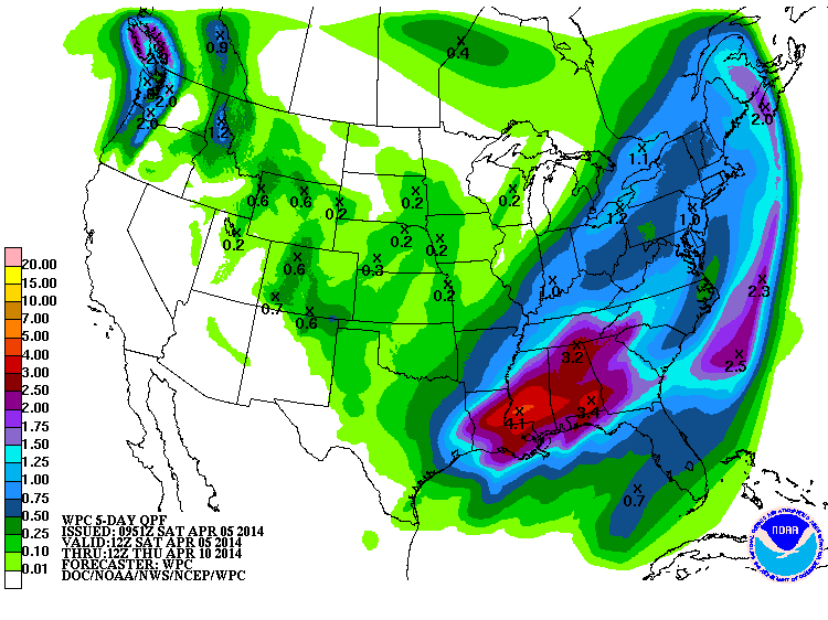
This could lead to some flooding issues, especially where storms back build and move over the same area. We will keep you posted on the threat over the weekend. Stay tuned…
Category: Alabama's Weather
About the Author (Author Profile)
James Spann is one of the most recognized and trusted television meteorologists in the industry. He holds the AMS CCM designation and television seals from the AMS and NWA. He is a past winner of the Broadcast Meteorologist of the Year from both professional organizations.Subscribe
If you enjoyed this article, subscribe to receive more just like it.


