

Flash Flood Watch Issued for Central Alabama
The NWS in Birmingham has issued a flash flood watch that will go into effect at 10 a.m. Sunday morning for much of Central Alabama.

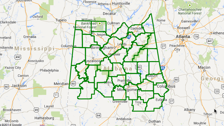
The watch includes:
Autauga, Barbour, Bibb, Blount, Bullock, Calhoun, Chambers, Cherokee, Chilton, Clay, Cleburne, Coosa, Dallas, Elmore, Etowah, Fayette, Greene, Hale, Jefferson, Lamar, Lee, Lowndes, Macon, Marengo, Marion, Montgomery, Perry, Pickens, Pike, Randolph, Russell, Shelby, St. Clair, Sumter, Talladega, Tallapoosa, Tuscaloosa, Walker and Winston Counties. It will go until 1 p.m. CDT Monday.
Widespread 2-3 inch rainfall amounts are expected between late tonight and early Wednesday, with some isolated heavier amounts. The bulk of the rainfall will occur between noon Sunday and noon Monday.
Category: Alabama's Weather, Severe Weather
About the Author (Author Profile)
Bill Murray is the President of The Weather Factory. He is the site's official weather historian and a weekend forecaster. He also anchors the site's severe weather coverage. Bill Murray is the proud holder of National Weather Association Digital Seal #0001 @wxhistorianSubscribe
If you enjoyed this article, subscribe to receive more just like it.


